A Geographical Information System (GIS) is a computer-based tool that allows users to capture, store, manipulate, analyze, manage, and present spatial or geographic data. It combines cartography, statistical analysis, and database technology to create interactive maps and models that help in decision-making processes.
GIS integrates various types of data and enables users to visualize, question, and interpret patterns and relationships in a geographic context.
The following is our course contents for our online GIS course, especially those designed for beginners to intermediate learners:
1. Introduction to GIS
-
Definition and scope of GIS
-
History and evolution of GIS
-
Components of a GIS: hardware, software, data, people, methods
-
Applications of GIS in various fields
2. GIS data types and sources
-
Spatial vs. non-spatial (attribute) data
-
Raster and vector data models
-
Data formats: shapefiles, GeoJSON, KML, etc.
-
Sources of GIS data (satellite imagery, surveys, GPS, open data portals)
3. Coordinate systems and map projections
-
Understanding latitude and longitude
-
Geodetic datums and projections (Arc1960, WGS84, UTM, etc.)
-
How projection affects overall map accuracy
-
Conversion between different coordinate systems
4. GIS software and tools
-
Introduction to ArcGIS, QGIS, or other platforms
-
Interface navigation and basic tools
-
Installing plugins and extensions
-
Creating and saving GIS projects

5. Spatial analysis and operations
-
Buffering, clipping, and overlay operations
-
Spatial joins and queries
-
Distance and area calculations
-
Terrain analysis (elevation, slope, aspect)
6. Working with attribute data
-
Attribute tables and data management
-
Querying and filtering GIS data
-
Data classification and symbology
-
Joining tables and linking external data
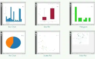
7. Map design and visualization
-
Cartographic principles (layout, legends, scale bars)
-
Thematic mapping (choropleth, heatmaps, symbol maps)
-
Map labeling and annotations
-
Exporting maps to PDF or other image formats
8. GIS data collection and field work
-
Using GPS or mobile apps for data collection
-
Data input and digitizing
-
Data accuracy and validation
9. Introduction to remote sensing (optional)
-
Basics of satellite imagery and aerial photography
-
Image classification and interpretation
-
Working with NDVI and other vegetation indices
10. GIS applications and projects
-
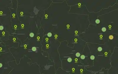
Real-world case studies (urban planning, climate change, disaster management, environmental monitoring)
-
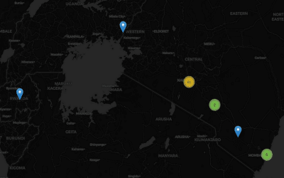
Mini web or online mapping project
-
Creating interactive online GIS maps or dashboards
-
Ethical considerations in geospatial work
OGC Online GIS Training Platform
GIS Courses 2025: https://orbital.co.ke/gis-and-remote-sensing-training-courses/ NITA Accreditation: https://orbital.co.ke/orbital-geospatial-college-ogc-gets-nita-certification/ Orbital College: https://ogc.or.ke/ | E-learning Platform: https://e-learning.ogc.or.ke/
Ad: Explore the world with Expedia

Flewflew: AI solutions provider in Africa

OrbiCollect: Mobile mapping made easier!

NSE Stock Market: Buy & Sell Shares

Join Binance and Let us win together!

AGM 6th Edition: Jan-Apr 2025