High resolution
Cost effective
Availble 24/7
Thermal images
High resolution Thermal images
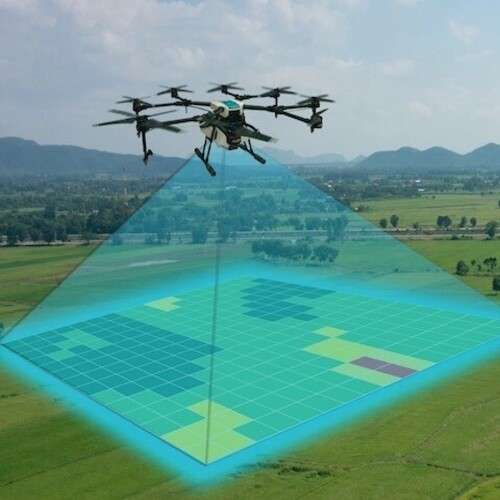
Thermal imaging and mapping is a drone-based survey technique, scientifically proven to identify and quantify distribution of temperature differences across a spatial phenomenon over a given time period. The technology is applied in inspection of solar panels, pipes etc.
The Sensor: DJI XT, XTR, XT2 (it requires the 640x512 configuration with any lens); Drone: DJI M200, M210, or M210 RTK, Inspire 1, Mavic 2 Enterprise Dual. The Thermal images are captured via the thermographic cameras using infrared (IR) light.

We employ latest Thermal based drones sensors such as Matrice 30T for thermal surveys.

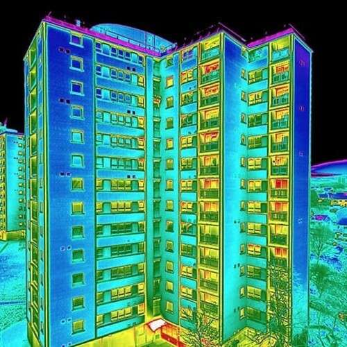
Accurate thermal images can be utilised in the inspection of buildings and other structures.

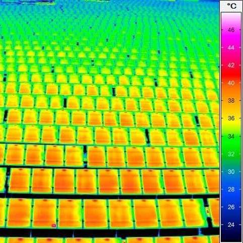
Thermal imaging can be tool for evaluating solar cells and panels to identify the faults and hotspots.
Ordering process
We have designed, developed and deployed an easy to use Thermal image ordering process using the following steps.
-
1
-
2
Online search
The search of images using criteria (% cloud cover, acquisition date, sensor - plane, drone etc.).
Read more -
3
Make payment
Upon satisfaction on the search results and invoice amount, the client makes payment.
Read more -
4
Delivery done
Once payment is received, the images are delivered via FTP download link or in CD to client.
Read more
Need more details or a demo? get in touch!
Accuracy and precision. Thermal imagery products are cost effective and ideal for all geospatial professionals.
