Professional
Unmatched
Cost-effective
3D laser scanning
3D laser scanning services in Africa
3D laser scanning is essentially the swift capture of three-dimensional (3D) information reflected from an object or surface to a light sensor. Once the point cloud data is processed, traditional deliverables; 2D plans, elevations, and sections can be readily extracted, or used for fly-throughs and contextual purp-
oses. After the scans are registered, a (3D) three dimensional database is established that can be used throughout the building’s lifecycle, or to aid in reconstruction should damage occur in the future. Sharp and descriptive photographic data is fused with the point cloud and viewed as dynamic panoramas.
We employ 3D terrestrial laser scanners and drones
We employ latest and state-of-the-art equipment for the 3D laser scanning services in Kenya and Africa.
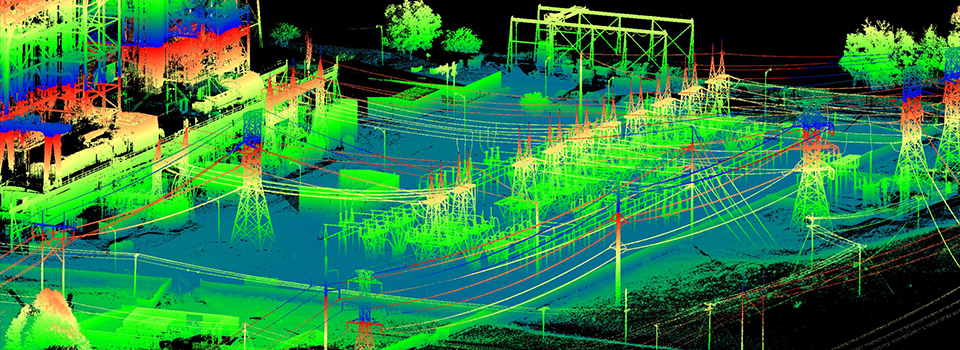
3D Laser Scanners are used for 3-D cross range data acquisition of objects to create 3D models.

Processed 3D models are used in the design of infrastructure e.g. roads, buildings, railways etc.
3D Laser Scanning Process
- Laser Emission: The scanner emits a laser beam onto the surface of the object.
- Reflection Capture: The laser reflects back to the scanner’s sensor.
- Distance Measurement: The time it takes for the laser to return to the sensor is measured, calculating the distance between the scanner and the object’s surface.
- Data Collection: Process is repeated across object’s surface, capturing millions of points (point cloud).
- Data Processing: The point cloud data is processed to create a detailed 3D model of the object.
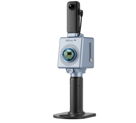
FJD Trion™ P1 LiDAR Scanner
Easy Reality Capture: Whether you are a seasoned laser scanning professional or just 3D-curious, a walk around the site with the P1 lets you digitize your environment quickly and accurately.
Compact Yet Mighty: Pick up the FJD Trion P1 whenever you want to take a closer look at your world. Weighing in at only 1 kg or slightly over 2 lbs, the P1 fits in a messenger bag and can work all day with easy battery swaps, recreating your environment in minutes.
Indoor, Outdoor, Underground… Scan all Day Long: Wherever you go, the P1 can capture what you see, always!
Relative Accuracy
Up to 2 cm*
Points Per Second
200,000
Scanner Weight
- Lightweight and Portable
- Net weight: 1 kg / 2.2 lbs
Scanning Range
40 m @ 10% reflectivity
70 m @ 80% reflectivity
More details on 3D scanning? get in touch!
Accuracy and precision. Reach out to us for unmatched and cost-effective 3D scanning services.
