Reliable
Cost effective
Integration of..
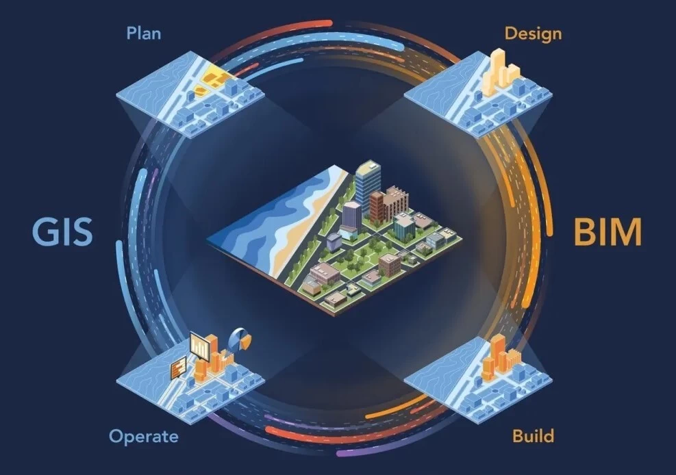
GIS and BIM
Reap from GIS and BIM products and solutions
Building Information Modelling (BIM) is the holistic process of creating and managing information for a built asset. Based on an intelligent model and enabled by a cloud platform, BIM integrates structured, multi-disciplinary data to produce a digital representation of an asset across its lifecycle, from planning and design to construction and operations. GIS adds spatial comp-
onent to BIM. Merging BIM with GIS data provides the location element that can be used in infrastructure design, thus allowing for more efficient workflows and consistent data. The evolution and emergence of BIM and GIS integration brings a whole new approach to construction, mapping as well as planning. This also contributes to improved decision-making processes.
Benefits of BIM-GIS integration
GIS & BIM is used in planning of infrastructures e.g. rail networks, airports, bridges, roads etc.
1). Seamless integration of data
Integrate data seamlessly between the stages of the project planning, design and construction process.
2). Adding spatial component to BIM
The integration of GIS and BIM enables the addition of effective spatial components to BIM projects better planning and execution of projects thereof.
3). Projects designs and processes
GIS and BIM leads to better, improved designs and processes hence eliminating the data redundancies and safes time.
4.) Data storage in the cloud
Storing the GIS and BIM data in the cloud improves its processing and management in any environment such as GIS or CAD.
5.) Elimination of data conversions
The integration of GIS and BIM eliminates the need to convert data for use in other contexts or platforms. Reusing the data is also possible.
More details on GIS & BIM? get in touch!
Utilize the power of GIS and BIM integration to analyse and discover the hidden information in 3D construction, survey, mapping and planning industries.
