Professional
Unmatched
Cost-effective
Bathymetric surveys
Bathymetric survey services in Africa
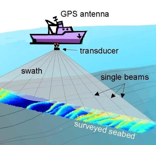
Bathymetric or Hydrographic Surveying is the survey of physical features present underwater and entails measuring the nature of sea, lake or river floor. It is the science of measuring all factors beneath water that affect all the marine activities like dredging, marine constructions, offshore drilling... At Orbital Africa Ltd.,
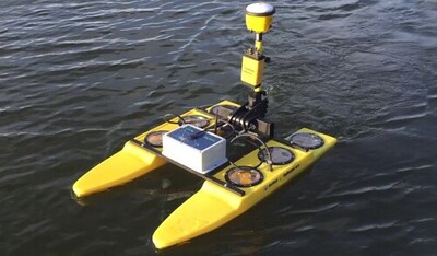
we offer professional and reliable Bathymetric and Hydrographic Survey services aimed at obtaining data about water depth, the shape of the sea floor and coastline, the location of possible obstructions, and other features of water bodies. Our team of surveyors uses Multibeam Sonar/Side Scan Sonar Echo-sounders
We employ echosounders, GNSS, 3D scanners and drones
We employ latest and state-of-the-art equipment for the bathymetric surveys in Kenya and Africa at large.
Bathy survey outputs are hydro designs, layouts, river/sea floor profiles and CAD drawings

The analysis of sea/river or dam floor terrain from bathy data is vital for ideal desiltation works
Details on bathymetric survey? get in touch!
Accuracy and precision. You can join our training institution and learn how to use iBoat BS2 to conduct bathymetric surveys.
