Professional
Unmatched
Cost-effective
Topographical surveys
Professional topo survey services in Africa
A Topographical survey is an accurate depiction of location (x,y,z) of an object, a feature or site (e.g. property, area of land or a defined boundary) which is scaled and detailed according to the spatial considerations (coordinates, bearings, distances etc.) and is the summary of on-site data capture processes.
The topographical survey determines the location of natural and man-made features (such as the buildings, improvements, fences, land contours, trees, streams, etc.) of the land along with its elevations. A topo map is used to depict terrain relief showing the ground elevation, using contour lines or spot heights.
We employ drones, GNSS, 3D scanners... count on us to deliver!
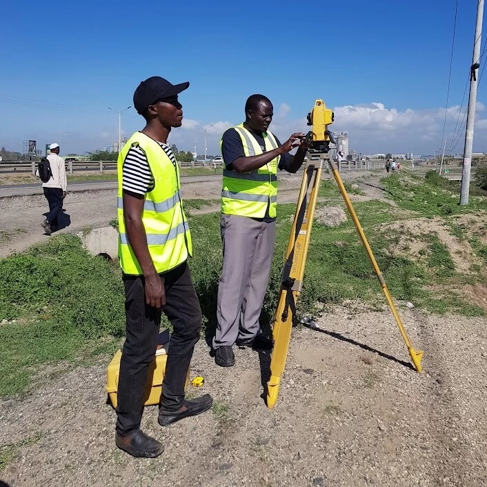
We employ latest and state-of-the-art equipment for the topographical surveys in Kenya and Africa at large.

Topo survey deliverables include topographical maps at scales of 1:500, 1:1000 or 1:50000

Spatial feature extraction from accurate 3D digital surface models (DSMs) e.g. buildings, roads etc.


Orbital offers Land, Topographical Surveying in Kenya with branches in Ethiopia, Tanzania, Uganda, south Sudan, Rwanda, Botswana and Africa at large. We carry out land, Topographic Surveys, Bathymetric Surveying, control, engineering survey and 3D Mapping Services in Kenya using latest and state-of-the-art technologies and tools such as GNSS/RTK, 3D Scanners, Total Stations and Drones.
The aim of topo survey is to: (i) Produce Topographical and Cadastral Maps of the project area; (ii) Map Topographic Features and generate topographic (cross-sectional) profiles; (iii) To establish the vertical and horizontal controls for accurately defining locations within project area. Continue reading more on topo surveys ++
Topo survey procedure
Detailed procedure for conducting topographical surveys can be accessed: [ here ++]
Sample topo projects
You can access [ here ++ ] the sample topo survey projects we’ve executed in the past.
Sample topo map
Here is a sample topo map for a past project: Kenya Airways Topographical Map ++
Training on topo survey
Get hands-on skills on how to use a total station or GNSS to conduct topographical surveys. Here are more details ++
Topo survey procedure
Like any other project, topo survey need to be conducted by adopting the following workflow
-
1
Reconnaissance
Ideal to gain information on nature of the sites, method of survey and equipment to use.
Read more -
2
Install Benchmarks
The benchmarks (BMs) are precisely installed to ensure accuracy in survey readings.
Read more -
3
Field survey
Entails picking and mapping of ground features and recording the coordinates (x, y and z).
Read more -
4
Data processing
Done in CAD or GIS software to generate topo and contour maps, profiles and layouts/plans.
Read more
More details on topo survey? get in touch!
Accuracy and precision. You can join our training institution and learn how to use Total station to conduct topo surveys.
