Professional
Unmatched
Cost-effective
GPR scanning
GPR underground utility scanning
GPR scanning is non-destructive method that uses electromagnetic radiation in the microwave band (UHF/VHF frequencies) of the radio spectrum, and detects the reflected signals from subsurface structures e.g. pipes, cables etc. GPR can pick up both metallic, non-metallic objects and utilities in a non-intrusive way.
GPR has more uses than just mapping underground utilities, with the right equipment and expertise it can be used for the following; pavement/bridge/roadway inspection, void detection, concrete slab analysis, rebar mapping, verifying as-built information of concrete walls and floors among others.
We employ USRadar Q5 GPR and GNSS for mapping

A GPR is a geophysical method that uses radar pulses to image and map the subsurface.

The GPR equipment is integrated with tablet with data collection software, GNSS and antenae.
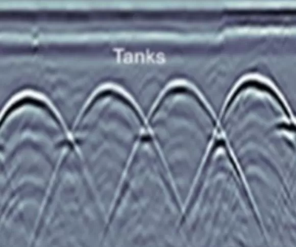
Processed GPR 3D data (i.e. the Radargrams) are interpreted to give location of utilities (x,y and z).
More details on GPR scanning? contact us!
Accuracy and precision. Reach out to us for unmatched and cost-effective GPR scanning services.
