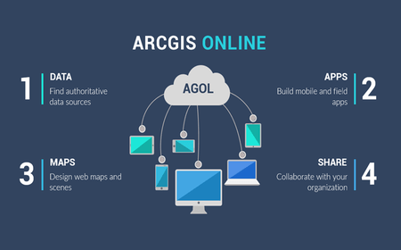
Capture
Analyse
Visualize
Disseminate
Spatial data
GIS Software
The GIS software: mapping the way to a better future!
At Orbital, we envision empowering all organizations to embrace this approach. By collectively creating and sharing multidisciplinary knowledge, we can make smarter decisions about managing our world—building a collaborative digital geospatial system for our entire planet. Together, we have the power to transform society and design a better, more sustainable future.
At Orbital, they envision empowering all organizations to embrace this approach. By collectively creating and sharing multidisciplinary knowledge, they can make smarter decisions about managing our world—building a collaborative digital geospatial system for our entire planet. Together, they have the power to transform society and design a better, more sustainable future.
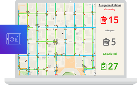
GIS workflow management system helps automate business processes across desktop, online and mobile platforms!
How does GIS work?
GIS technology applies geographic science with tools for understanding and collaboration. Goal? To gain actionable intelligence from all types of spatial and non-spatial data!
1.) Map design and production
Maps are the geographic container for the data layers and analytics you want to work with. GIS maps are easily shared and embedded in apps, and accessible by virtually everyone, everywhere.
2.) Spatial and non-spatial data
GIS integrates many different kinds of data layers using spatial location. Most data has a geographic component. GIS data includes imagery, features, and basemaps linked to spreadsheets and tables.
3.) Spatial analysis workflows
Spatial analysis lets you evaluate suitability and capability, estimate and predict, interpret and understand, and much more, lending new perspectives to your insight and decision-making.
4.) GIS app development
Apps provide focused user experiences for getting work done and bringing GIS to life for everyone. GIS apps work virtually everywhere: on your mobile phones, tablets, in web browsers, and on desktops.
5.) GIS users community
Modern GIS is about participation, sharing, and collaboration. Discover how the technology is strengthening relationships, driving efficiencies, and opening communications channels in your community. The GIS sectors include: health, education, banking, real estate, utilities, telecomms etc.
GIS portal
We have created a GIS web mapping platform for sharing and dissemination of geodata and information for various industries such as construction, agriculture, utility etc.
GIS training
Orbital offers a wide range of GIS and remote sensing training courses covering the topics related to Geospatial technology, survey, engineering as well as mapping.
Need more details or a demo? get in touch!
Several organizations in virtually every fields are using GIS to make maps that communicate, perform analysis, share information, and solve problems globally.


