Orbital Geospatial College (OGC) conducted training on Geographical Information System (GIS) applications in Water Resource Management to four (4) technical staff members from Blantyre Water Board from the Republic of Malawi. The 2-week training took place from 30th June to 11th July 2025 at OGC premises located in Karen, Nairobi Kenya. The course covered were [1] BC101 – Introduction to Geographical Information System Course and [2] CC304 – GIS for Water Resource Management Course. These courses focused on the introduction and application of GIS and remote sensing technologies in the water distribution systems modeling, flood plain management, hydrological modeling, spatial interpolation, watershed delineation, water quality assessment and planning, constructing a ground water simulation model and connecting the spatially referenced time series data.
Blantyre Water Board is a parastatal organization established and reconstituted under the Malawi Water Works Act No. 17 of 1995 to supply potable water for commercial, industrial, institutional and domestic use in the supply area of Blantyre City and surrounding areas. Its mission is to provide reliable and affordable water supply services to customers whilst effectively contributing to the development of the national economy and sustenance of the environment. Currently, the Board is supplying water to about 1.4 million people within its supply area, which includes the City and surrounding areas such as Bvumbwe, Chileka, Lunzu, Chiradzulu, Limbe and Mapanga.

BWB extracts its water from Shire River (an outlet of Lake Malawi) at Walker’s Ferry approximately 40 kilometers away and 800m below Blantyre City. As BWB’s main treatment plant, it currently produces 96 million litres per day, which is 95% of the total water production, with the rest being produced from Mudi dam and boreholes. After the completion of the new water source project from Likhubula in Mulanje, Walkers Ferry will then produce 79% of the total production. Mudi Dam currently produces 5 million litres and Likhubula source is expected to produce 20 million litres.
BWB has four broad categories of customers namely; domestic, industrial, institutional and commercial customers. Currently BWB has about 80,000 active customers. BWB registers an average of 300 water connections every month.
Back to GIS training! The aim of this course is to provide both a solid theoretical understanding and a comprehensive practical introduction to the use of GIS and remote sensing technologies for the analysis of water related data and provision of solutions to various water and environmental problems. As well, GIS saves time and money in developing water distribution system hydraulic models for simulating water flows and pressures in the system. As well, GIS also helps in presenting the model results to non-technical audiences.
Training course contents
- Introduction to GIS concepts: Definitions of core geospatial terminology and concepts; Objectives, components and applications of GIS; The history of GIS – how it is used today, and the future of GIS; Introduction to GIS Software – QGIS and ArcGIS Basics etc.
- Spatial Reference Systems: Coordinate and Spatial Reference Systems; Datums and Ellipsoids; Map Projections; Coordinate Transformations.
- Nature of GIS Data: Data types and models; Data Characteristics & metadata; Feature representation in GIS; GIS data sources; Data Capture; A shapefile and Feature class; Data Editing; Geo-referencing; Digitizing in GIS; Spatial and Attribute Data.
- Geospatial Data Management: GIS Data File Formats; The Geodatabases: Features and Design; File Geodatabases, Personal Geodatabases; Introduction to GIS database (Microsoft SQL), functions and applications; Maintaining spatial and attribute data integrity using subtypes; Performing GIS data validation; Updating and managing the GIS databases.
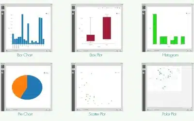
- Geospatial Analysis: Introduction to raster data Analysis; Extraction, Digital Elevation Models, Classification, etc.; Introduction to vector data Analysis; Buffering, Clipping, etc.
- Overview of GIS and Remote Sensing: GIS components; Sources of GIS and remote sensing data; types of satellite images; use of drones; application of GIS and RS in water resource management.
- GIS Technology in Water Resource Management: GIS tools for water resource management; use of aerial photos, drone and satellite images; Digital Elevation Models (DEMs); the GIS databases; GIS spatial analysis.
- Spatial Interpolation: Spatial and spatio-temporal models of land surfaces, climatic phenomena (e.g.,precipitation and temperature), soil properties, and water quality from measured data; ANUDEM and TOPOGRID elevation griding procedures.
- GIS in Watershed Delineation: Use of satellite data and GIS technology to map water bodies and resources such as rivers, lakes, dams and reservoirs in 3D GIS environment; GIS algorithms for the delineation of watershed and extraction of stream networks from DEMs.
- Floodplain Management: Use of GIS models in hydrological analyses by aiding in the determination of water surface profiles associated with different flow conditions etc; Use of HEC-RAS hydraulic model and GIS.
- Closed Basin Hydrology: Geospatial data e.g. satellite images to manage water basins; integration of groundwater simulation models with GIS model builder.
- Time-Series Satellite Data: Connecting spatially referenced time-series satellite data with GIS; Analyzing hydrological changes with time-series data among others.
The training was conducted successfully and trainees awarded the certificates of completion. Our institution OGC is accredited by NITA to offer training in Kenya and Africa at large.
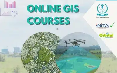
- GIS Courses 2025: https://bit.ly/4kFUU8E
- NITA Accreditation: http://bit.ly/44Cxjzt
- Orbital College: https://ogc.or.ke/
- E-learning Platform: https://e-learning.ogc.or.ke/
Ad: Explore the world with Expedia

Flewflew: AI solutions provider in Africa

OrbiCollect: Mobile mapping made easier!

NSE Stock Market: Buy & Sell Shares

Join Binance and Let us win together!

AGM 6th Edition: Jan-Apr 2025