
China Constructs the world-record-breaking 22 km Highway Tunnel
For decades, driving across China’s Xinjiang Uygur Autonomous Region has [...] Continue reading
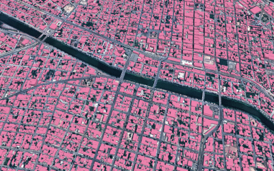
Maxar Intelligence released a new mapping product developed with Ecopia […]
Continue reading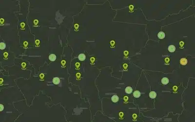
A GIS Dashboard features a user-friendly, interactive web application GIS […]
Continue reading
Mobile data collection is a method of compiling qualitative and […]
Continue reading
The OrbiCollect software is a modern and robust mobile data […]
Continue reading
Orbital Geospatial College (OGC) conducted training on Geographical Information System […]
Continue reading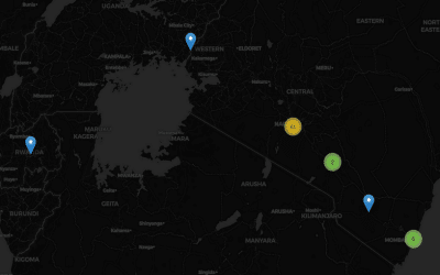
We have developed a complete GIS Based Accidents and Incidents […]
Continue reading
A Land Information and Management System (LIMS) is a web […]
Continue reading
Orbital Geospatial College (OGC) is a leading geospatial and technology […]
Continue reading
DataPlotly plugin for QGIS is a significant development in integration […]
Continue reading


OrbiCollect: Mobile data collection made easier for organizations and individuals!
This will close in 20 seconds