Orbital Africa is proud to announce a strategic partnership with […]
Continue reading
Orbital Africa is proud to announce a strategic partnership with […]
Continue reading
Orbital has partnered with Flexflew to design and develop Orbital […]
Continue reading
In July 2025, Kenya Space Agency (KSA), in partnership with […]
Continue reading
Introduction In today’s data-driven world, Machine Learning (ML) and Artificial […]
Continue reading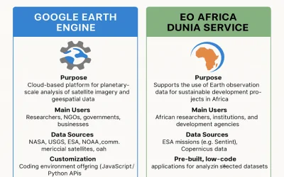
EO Africa Dunia Service The EO Africa Dunia Service is […]
Continue reading
On average, over 500 hours of content are uploaded to […]
Continue reading
A frantic race by leading tech giants to develop ever […]
Continue reading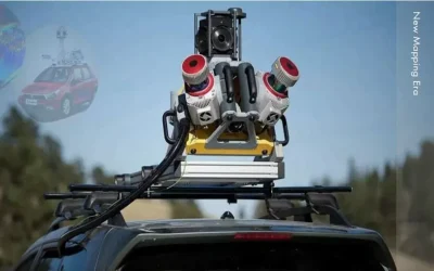
What is mobile mapping? Mobile mapping is a method of […]
Continue reading
GIS based land management solutions support dynamic decision making through […]
Continue reading


OrbiCollect: Mobile data collection made easier for organizations and individuals!
This will close in 20 seconds