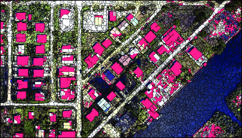
Maxar Intelligence released a new mapping product developed with Ecopia AI that converts satellite imagery into detailed 2D and 3D maps. The product, called Vivid Features, combines Maxar’s satellite imagery archive with Ecopia’s artificial intelligence software to automatically identify and outline buildings, roads, vegetation, water bodies and other features.
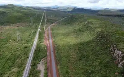
Vector maps, unlike traditional raster images, represent the world using geometric shapes — points, lines and polygons — instead of pixels. They store location data as mathematical equations, making them more precise and easier to update. That precision is critical for everything from urban planning to defense operations, but keeping vector datasets current has historically been labor-intensive and slow.
Ecopia, founded in 2013, specializes in using artificial intelligence to extract features from high-resolution satellite imagery and build what it calls a “digital twin of the Earth.” Its machine learning models can pick out and outline buildings, roads, vegetation, waterways and more with minimal human intervention.
By combining those algorithms with Maxar’s global satellite archive, the companies say they can automatically generate vector maps that update as the real world changes.
Maxar is also bringing software to the partnership, specifically fusion software that unifies imagery to the same level of accuracy (3 meters), a company spokesman said. “We apply that before the data goes into Ecopia AI’s mapping system, which then extracts just the vectors.” The fusion process ensures that the vectors that are produced through Ecopia’s software remain interoperable.
“Vivid Features, powered by Ecopia, solves one of the most persistent challenges in digital mapping — the time-consuming process of producing consistent vector map data of every place on Earth,” said Peter Wilczynski, Maxar’s chief product officer. “Together, we’ve created a product that eliminates the thousands of hours customers typically spend manually creating and aligning vectors, providing a dynamic basemap suite that maintains fidelity as the world changes.”
Commercial and defense demand
The potential use cases include government agencies that rely on accurate geospatial data for emergency planning, disaster response and infrastructure management. Commercial players use it for risk modeling in insurance, planning telecom networks and tracking population growth.
For military users, the companies said, vector maps could serve as a backbone of geospatial intelligence feeding into mission planning and decision making.
“Gaining an up-to-date, three-dimensional understanding of our planet and how it is changing is one of the most complex challenges our customers face,” said Jon Lipinski, Ecopia’s president and co-founder. “While millions of square kilometers of satellite images are captured each day, many organizations struggle to develop corresponding 3D vector maps and keep them current to reflect real-world change. This partnership with Maxar will enable unprecedented access to up-to-date 3D vector maps across the globe.”
Credits: spacenews.com
Latest News and Technology Articles: https://orbital.co.ke/blog/
Mobile Data Collection Solution: https://orbitalafrica.com/orbicollect/
Our Contacts: T: +254 719 672 296 | E: [email protected] | W: https://orbital.co.ke
Ad: Explore the world with Expedia

Flewflew: AI solutions provider in Africa

OrbiCollect: Mobile mapping made easier!

NSE Stock Market: Buy & Sell Shares

Join Binance and Let us win together!

AGM 6th Edition: Jan-Apr 2025