
China Constructs the world-record-breaking 22 km Highway Tunnel
For decades, driving across China’s Xinjiang Uygur Autonomous Region has [...] Continue reading
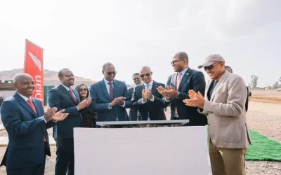
Ethiopian Prime Minister Abiy Ahmed (PhD) on Saturday, January 10, […]
Continue reading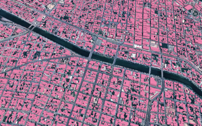
Maxar Intelligence released a new mapping product developed with Ecopia […]
Continue reading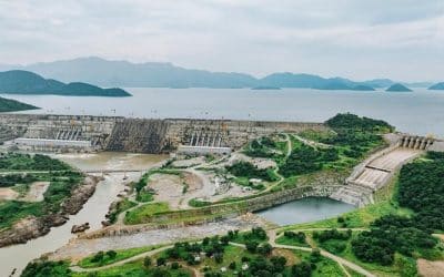
Grand Ethiopian Renaissance Dam (GERD) was constructed between 2011 and […]
Continue reading


Geographical Information Systems (GIS), remote sensing and mapping play a […]
Continue reading
According to Kenya Space Agency, Taifa-1 Sat is Kenya’s first […]
Continue reading


OrbiCollect: Mobile data collection made easier for organizations and individuals!
This will close in 20 seconds