Mobile data collection is a method of compiling qualitative and quantitative data with the help of a digital or mobile device (e.g. mobile phone, tablet, GPS etc.). We have documented top 15 Mobile GIS Data Collection and Mapping Tools in 2025 to enable you choose the best app use in order to avoid the hassle of having to transcribe data or the fear of it being lost you can use a data collection app. Normally collecting research data with paper forms can be a daunting task. It poses many predicaments e.g. data loss, lack of data backup, time consuming, high cost etc. In this guide you will find 15 solutions that will help you capture high-quality field data. Whether you are working offline or need to gather sensitive field data.
In today’s data-driven world, collecting data is the lifeline of decision-making, strategy formulation, and innovation. Picture this: a healthcare provider leveraging mobile app surveys to gather patient feedback instantly after appointments, a retail chain conducting on-the-spot inventory checks using tablets, or a field researcher capturing environmental data with a few taps on a smartphone.
Mobile data collection tools have become the linchpin of modern-day operations, offering unparalleled convenience, accuracy, and speed in gathering information from customers. While the data can also be collected through paper forms, they often lack the efficiency, real-time updates, and instant accessibility that mobile tools provide.
From surveys to field research, audits to customer feedback, these tools empower diverse industries to efficiently collect vital data, shaping a future where insights are instantaneous and decisions are made in real time.
What is data collection software?
Data collection software is a computerized system for the collection and storage of qualitative and quantitative data in an electronic form. The benefits of using data collection systems is that they eliminate the use of paper surveys and allow data to be quickly exported for data analysis and reporting.
Data collection software was first introduced in the early 1980s to address the many shortcomings of paper-based forms, such as increased errors through transcription and late detection of inaccuracies. The first of these systems to become widely adopted where Microsoft Access and MySQL. With the turn of the century came the cloud, which expanded any web browser into a platform to visualize and complete forms. This innovation was the big bang of the paper-less movement.Despite the advances in web-based data entry systems, historically field researchers and clinical teams working on the go have still suffered from the burden of paper-based data gathering. This is due to a simple reason: web-based data recording tools become useless when there is no internet. Although smartphone adoption in the world has skyrocketed in the last five years, internet access has not increased at the same speed, and so much of the world today remains offline.
Capturing field data offline
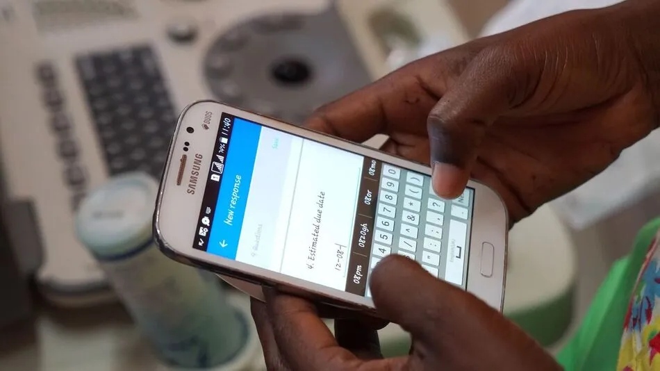
Data collection apps are mobile applications that make it possible to collect data from a smartphone, tablet or iPad. One of the main advantages of data collections apps is the possibility of gathering data offline or while on-the-go. Offline forms allow researchers that are working in places with unreliable internet to store a backup of their data on their mobile device and upload it once an internet connection is available.
As researchers today see the immense advantages of using mobile survey apps over paper-based forms, the number of data collection solutions grows. With this article, we hope to answer the question of which of these options may suit your research purposes best. We also suggest you read our guide on the best practices for offline data collection for an in-depth view on how to successfully capture in remote areas.
Five (5) considerations when collecting data offline
1. Synchronize your data as soon as you can: To mitigate the risk of data loss, synchronize your data as soon as possible. Establish a standard operating procedure (SOP) with your field team and minimize the risk of offline data being lost by scheduling periodical moments when data will be synchronized with your server.
2. Don’t clear ‘app data’ or reinstall the app otherwise offline data may be lost: Deleting a mobile app can permanently remove any data that is associated with it. Only delete an app once you are sure that all of the local data has been uploaded to a server.
3. When uploading a batch of offline form entries, check for the fastest connection: Depending on your internet connection and the amount of data in those form entries, it can take seconds or up-to minutes to fully upload all of your data.
4. Don’t use mobile notifications that require an immediate reaction: Mobile notifications, also known as push notifications, allow apps to notify users without them having to open an application.
5. …
Here are top 15 Mobile data collection apps that you need to consider for field mobile data collection.
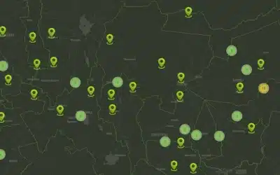
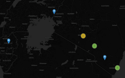
1. OrbiCollect
Orbicollect
2. KoboToolbox (Android & Web)
Theeeee3. Zonka Feedback
Zonka Feedback stands as a powerful mobile data collection app, streamlining the process of gathering insights through surveys on the go. With mobile-optimized surveys, real-time analytics, and offline data collection, it empowers seamless data collection on smartphones and tablets. Its versatile features, from multimedia integration to location-based insights, ensure comprehensive and secure mobile data collection for actionable decision-making.
Key Features
-
Tailor mobile–optimized survey templates like customer satisfaction survey templates, product feedback form templates, healthcare patient satisfaction survey templates, and etc., designed specifically for mobile devices, ensuring accessibility and ease of response for participants on smartphones or tablets.
- 30+ question types for creating microsurveys on CX metrics like Net Promoter Score, Customer Effort Score, and Customer Satisfaction Score that can be deployed in-app easily.
- Through offline data collection, gathered data is synced automatically even without an internet connection, ensuring uninterrupted survey collection in various settings.
- AI features like sentiment analysis, language translation and workflow automation ensure accurate feedback interpretation and efficient processing of responses for actionable insights.
- Instant access to real–time advanced reporting and analytics for data insights as they’re collected, facilitating prompt decision-making and action based on current information.
- Integrate multimedia elements (images, videos) within surveys, to enhance engagement and data richness in mobile responses.
- Utilize GPS coordinates capabilities to capture location-specific data, facilitating geographical insights and customer journey mapping.
- Data security through encryption and compliance measures for safeguarding sensitive submitted information collected via mobile devices.
- Powerful integration with business tools like Salesforce, Zendesk, Freshdesk, Slack, Mailchimp, Webex, Google Analytics, AirTable, Intercom, Zoom, and more.
- Utilize dynamic survey features like survey logic and branching, answer piping, multilingual surveys and survey redirection for efficient data collection.
- Share unlimited forms across various channels, including email surveys, SMS surveys, Android surveys, kiosk mode and more for seamless distribution and accessibility for respondents across different touchpoints and devices.
Pricing
-
Starts at $49/month billed annually
Ad: Explore the world with Expedia

Flewflew: AI solutions provider in Africa

OrbiCollect: Mobile mapping made easier!

NSE Stock Market: Buy & Sell Shares

Join Binance and Let us win together!

AGM 6th Edition: Jan-Apr 2025