Static Survey and the Establishment of 176 GCPs in Nairobi, […]
Continue reading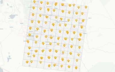
Static Survey and the Establishment of 176 GCPs in Nairobi, […]
Continue reading
The design and development of a smart GIS app or […]
Continue reading
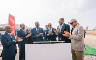
Ethiopian Prime Minister Abiy Ahmed (PhD) on Saturday, January 10, […]
Continue reading
Orbital Africa is proud to announce a strategic partnership with […]
Continue reading
Orbital has partnered with Flexflew to design and develop Orbital […]
Continue reading
The 67-kilometer Ngong–Suswa Highway is now complete according to the […]
Continue reading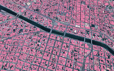
Maxar Intelligence released a new mapping product developed with Ecopia […]
Continue reading
Grand Ethiopian Renaissance Dam (GERD) was constructed between 2011 and […]
Continue reading
In July 2025, Kenya Space Agency (KSA), in partnership with […]
Continue reading


OrbiCollect: Mobile data collection made easier for organizations and individuals!
This will close in 20 seconds