In this article, we’re going to explore what LIDAR technology is, why it’s being used with drone device technology, and how it’s being used in construction industries and markets, as well as why it’s probably going to expand in popularity over the coming years.
There’s no denying that drones have fully integrated themselves into our everyday lives and that of industries around the world. New related technologies are being developed and implemented all the time to help bring new opportunities to businesses and projects, a key one being LIDAR.

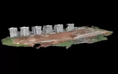
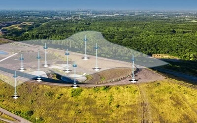
Drone-based Light Detection and Ranging (LiDAR) technology used to help construction projects managers accurately complete a straightforward task; to capture incredibly high-quality elevation data that are insanely accurate and allows for the most precise measurements.
LIDAR technology uses sensors that emit laser beams that shoot down to the ground and bounces back. The distance of the laser and back to the sensor is then measured and recorded. It has become an essential tool in various fields and sectors including forestry, construction, agriculture, mining and urban planning.

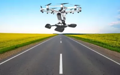
LiDAR drones are any drones made to carry a LiDAR sensor used to collect data that can be used to make detailed 3D models for a variety of applications and industries.
Drones equipped with cameras give companies an extra pair of eyes in the sky, providing a new perspective on operations happening on the ground. Across industries as varied as construction, emergency services, agriculture, and utilities, drones are adding value.
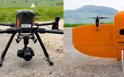
Selecting the right drone for LiDAR applications is crucial for achieving accurate and efficient data collection. Here are ten of the best drones for LiDAR mapping, considering factors such as payload capacity, flight time, precision, and usability.
By deploying a drone equipped with a LiDAR sensor, companies can take more accurate aerial readings — creating 3D models with centimeter-level accuracy and detecting features that would be invisible to less sophisticated methods.
Far from being a niche technology area, LiDAR is reaching all types of industries that need mapping and geospatial data collection services. By tracking the latest uses of LiDAR sensor drones, you can determine if these useful UAVs fit into your business’s plans.
1. DJI Matrice 300 RTK

-
- Payload capacity: Up to 2.7 kg
- Multi-payload support: LiDAR, thermal and multi-spectral sensors etc
- Flight time: Up to 55 minutes
- Maximum flight altitude: 7,000 meters
- Features: RTK capability, advanced AI capabilities, and the ability to carry various LiDAR sensors for accurate mapping.
2. senseFly eBee X

-
- Payload capacity: Up to 1.6 kg
- Flight time: Up to 90 minutes
- Supported modules: RTK and PPK
- Drone image accuracies: 1.5 cm (absolute)
- Features: Fixed-wing drone with long flight range and the capacity to integrate with various LiDAR sensors, making it ideal for large area mapping.
3. DJI Matrice 600

-
- Payload capacity: 9.1 kg
- Flight time: Up to 30 minutes
- Maximum ascent speed: 5m/s
- Features: Designed for professional aerial mapping with compatibility for multiple LiDAR systems; good stability and robust design.
4. Quantum Systems Trinity F90+

-
- Payload capacity: Up to 1 kg
- Flight time: Over 90 minutes
- Maximum range: Up to 100 km
- Maximum coverage area: 700 hectares
- Maximum takeoff weight: 5 kg
- Maximum flight altitude: 5,000 m
- Cruise speed: 70 km/hr
- Features: VTOL (Vertical Take-Off and Landing) design, making it highly versatile for both mapping and surveying applications.
5. Parrot Anafi USA
-
- Payload capacity: Up to 0.5 kg
- Flight time: Up to 32 minutes
- Maximum ascent speed: 4m/s
- Maximum flight altitude: 6,000 m
- Features: Dual-zoom camera, thermal imaging capability, and can be integrated with third-party LiDAR sensors for enhanced data collection.
- Applications: Anafi’s combination of advanced imaging systems, robust flight performance, and rapid deployment capabilities makes it a valuable tool for professionals requiring reliable aerial intelligence in various environments.
6. WingtraOne GEN II

-
- Payload capacity: Up to 1.5 kg
- Maximum takeoff weight: 4.5 kg
- Flight time: Up to 59 minutes
- Cruise speed: 16 m/s
- Maximum flight altitude: 4,800 m
- Telemetry range: Up to 10 km
- Features: Delivering high-quality aerial maps and models, integrating seamlessly with LiDAR sensors for professional-grade survey data.
- Applications: The drone is ideal for professionals in surveying, agriculture, and environmental monitoring.
7. Delair UX11

-
- Payload capacity: Up to 1.5 kg
- Flight time: Up to 59 minutes
- Flight range: Up to 53 km
- Features: Fixed-wing drone optimized for long-range missions, with accurate RTK capabilities for precise mapping.
- Applications: Delair UX11’s combination of advanced imaging systems, precise navigation, and efficient flight performance makes it valuable tool for professionals requiring reliable aerial intelligence in various environments.
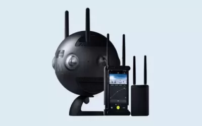
8. RIEGL VUX-1 UAV

The RIEGL VUX-1UAV is a lightweight, compact LiDAR sensor designed specifically for UAVs or drones. It offers high-precision laser scanning capabilities, making it suitable for various applications such as surveying, mapping and industrial inspections. Its specs include:
-
- Payload capacity: Up to 3.5 kg
- Payload capacity: Compatible with several drones
- Flight time: Dependent on drone used
- Scan speed: 10 to 200 scans per second
- Features: High-performance LiDAR sensor designed specifically for UAV applications; offers excellent range and point density.
9. Skycatch Explore 2 UAS

-
- Payload capacity: It varies with configuration
- Flight time: It varies (generally over 30 minutes)
- Features: Optimized for construction and mining sites; can carry several different LiDAR payloads for effective mapping and analysis.
10. Yuneec H520
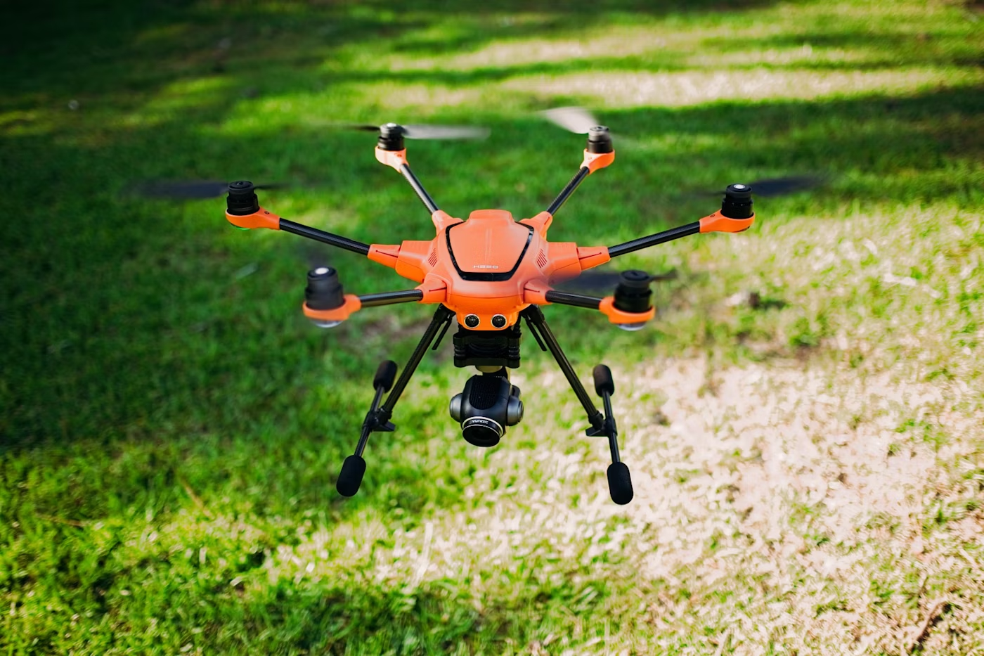
-
- Payload capacity: Up to 1.5 kg
- Flight time: Up to 28 minutes
- Maximum ascent speed: 4 m/s
- Maximum flight height: 500 m
- Features: Hexacopter design for stability and redundancy, along with compatibility for several LiDAR sensors.
GIS training courses catalogue: Here ++ | E-mail address: [email protected] | WhatsApp No: +254 719 672 296
Ad: Explore the world with Expedia

Flewflew: AI solutions provider in Africa

OrbiCollect: Mobile mapping made easier!

NSE Stock Market: Buy & Sell Shares

AGM 6th Edition: Jan-Apr 2025