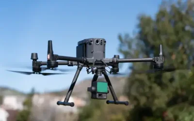
YellowScan, a global leader and designer of the next generation of manned and unmanned LiDAR solutions. In January 2024, The YellowScan announced the release of its new bathymetric system, the YellowScan Navigator. YellowScan Navigator is a system specifically designed for conducting bathymetric LiDAR surveys. Bathymetric LiDAR, in particular, is used to map underwater terrain, such as the depth of bodies of water, riverbeds, or even submerged structures. In the recent past, many regions across the world has witnessed the impact of climate change: drier and warmer seasons, interspersed by heavy rains and flooding rivers. These environmental hazards have a huge impact on human activities as well as the infrastructure. Precisely, mapping both waterbed and land is mandatory for monitoring, modeling, and mitigating coastal erosion, flood hazards and understanding biodiversity habitats.
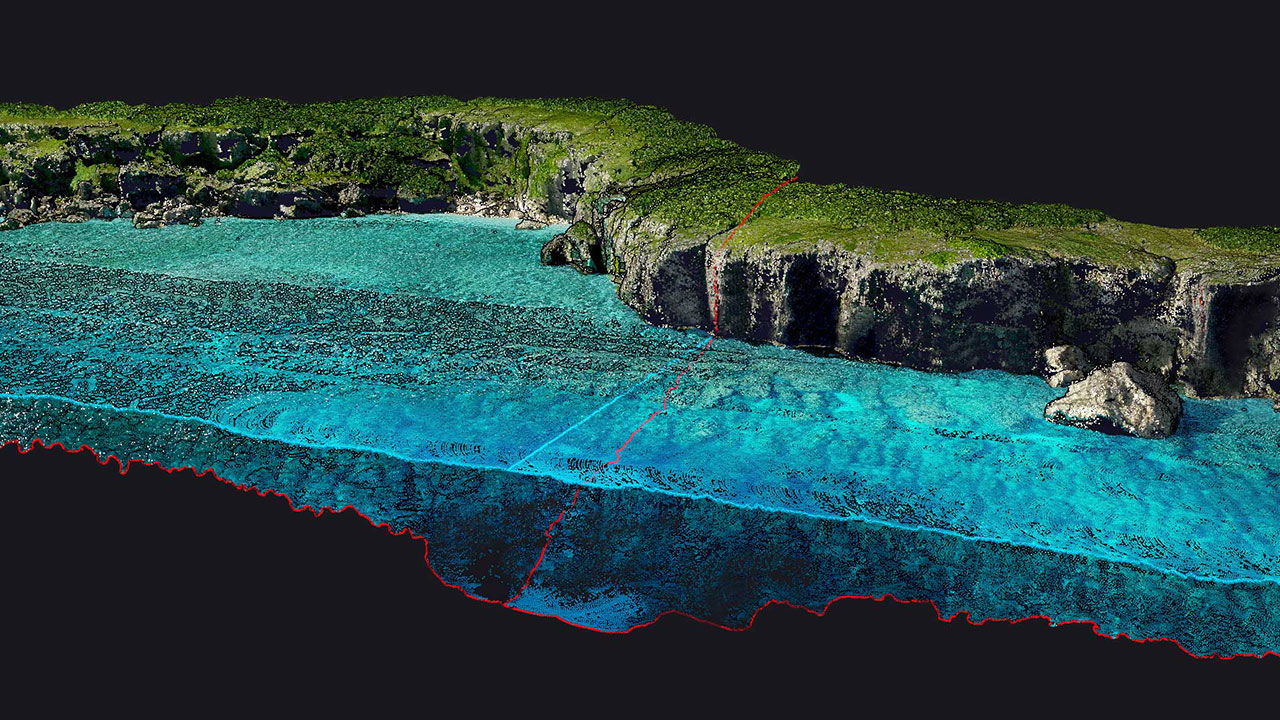
The Navigator system would likely include LiDAR sensors capable of penetrating water to measure bathymetry, as well as a suite of software tools for data processing and analysis. Such a system would be invaluable for tasks like hydrographic surveying, coastal mapping, and underwater infrastructure inspection. It can also provide highly accurate and detailed information about the underwater topography, aiding in various industries including marine construction, dredging of dams, desiltation of rivers, resource management and environmental conservation. Navigator sensor uses LiDAR to measure the ground surface above AND below a water surface.
Also read this interesting article: A single beam or multi beam echo sounder for bathymetric survey?
According to duncan-parnell.com, The Navigator measures to two times the Secchi depth. The Secchi depth is a measurement of how deep you can physically see, varying greatly based on the water quality. For example, if you can see to a depth of 6 feet, the Navigator will measure the bottom down to approximately 12 feet.

YellowScan has pioneered the LiDAR mapping from drones since 2012, offering precise instruments that have improved many surveyors’ day-to-day operation. YellowScan constantly aims at developing outstanding products that address the evolving needs of the market. This year, YellowScan is excited to introduce and release the YellowScan Navigator to the market. It is dedicated to fulfilling the crucial need of surveyors to map underwater topography, in dams, rivers, lakes, ponds and coastal areas.
According to YellowScan website, The Navigator is an innovative bathymetric LiDAR solution which features a laser scanner developed in-house over the last five (5) years, and has been heavily tested to achieve optimal performance. This compact system is fine-tuned to map waterbeds within a depth range of 0 to 3 meters, but it reaches a depth of 18 meters in perfectly clear water conditions. It can be flown up to 100m above the water surface and provides measurements with a precision and accuracy of 3 centimeters. Additionally, a camera is embedded to provide true-color data colorization.
Technical specs of Navigator
- AGL Altitude – Up to 100m
- System precision – 3cm
- Weight (battery excluded) – 3.7kg
- Typical flight speed – 5 m/s
- Laser range – Up to 120 m
- Scanner field-of-view – 44°
- Shots per second – Up to 20 000
- Scanning frequency – Up to 50 Hz
- Size – L 350 x W 160 x H 190 mm
- Continue reading >>>
Characteristics of Navigator
Multi-platform Adaptability: This system can be used on multirotor or helicopter UAVs. When it comes to drones, the “quick release” GREMSY attachment allows for easy mounting on a wide range of drones.
Simultaneous Land and Water Survey: It is designed for conducting bathymetric measurements in shallow waters and is rapidly deployable on a UAV. This full waveform LiDAR system ensures continuity between underwater points and the surrounding terrain.
Diverse Water Environments: It is intended for aerial use on drones, the system covers various water areas such as shorelines, rivers, lakes, estuaries, ponds and gravel pits. Navigator is user-friendly and adaptable for a wide range of applications, from hydrographic surveys to underwater resource management.
High Autonomy for Maximized Efficiency: With Navigator, you can optimize your bathymetric survey operations with our LiDAR system, delivering a 45-minute autonomy on a single battery charge for extended underwater data collection in various marine settings.
Embedded Camera: The Navigator features an embedded camera (global shutter) that can be used for colorization for visualization purposes.
Navigator Hardware
- YellowScan Navigator
- Rugged pelicase
- 2 Batteries
- UAV GNSS antenna and cable
- 2 USB flash drives
- Documentation and guides
- Laser Safety Goggles
Navigator Market Price
The cost of acquiring Navigator with all of its accessories is approx. USD. 35,700
Source of Content: YellowScan Website
Ad: Explore the world with Expedia

Flewflew: AI solutions provider in Africa

OrbiCollect: Mobile mapping made easier!

NSE Stock Market: Buy & Sell Shares