During the Months of April – June 2024, Orbital Africa was contacted and contracted by the Ministry of Energy from Malawi to offer advanced training and capacity development to select staff members in the Applications of Geographical Information Systems (GIS) in Energy and Power Utility Management. A total of six (6) Energy Engineers were trained.
The engineers trained include: 1.) Petros Nyirenda 2.) Happy Kadewere 3.) Eustace Gondwe 4.) Regina Kulugomba 5.) Gift Fandika and 6.) Amos Milonde. The GIS training took 2 weeks. The training and capacity development of the energy engineers in GIS is crucial for enhancing their ability to analyze spatial data, optimize energy systems and support decision-making processes.
Customized GIS Training Approach
The structured training approach which we employed as OGC, enabled the energy engineers to develop robust GIS skills that enhance their ability to analyze various spatial data, optimize the energy systems and contribute to the sustainable energy solutions. Our approach to this GIS training for the participants entailed the following:
Introduction to GIS and Mapping
Understanding GIS and mapping: Introduction to the basic and advanced GIS concepts, mapping, history, developments, key components and applications in various industries and sectors.
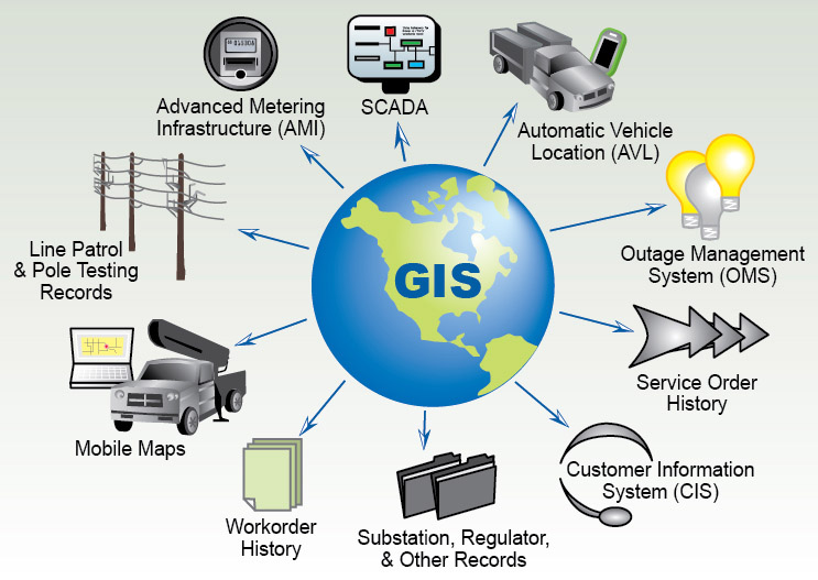
Applications of GIS in Energy Sector: Overview of how GIS is applied in energy utility generation, transmission, distribution, regulation and conservation. Furthermore, advanced GIS utility network analysis as well as modelling was done on optimization of energy distribution.
Overview of GIS Software Training
ArcGIS and QGIS Software: The training was conducted leveraging on the powerful ArcGIS and QGIS software solutions as well as other relevant tools GIS programming software such as Python, Javascript and R.
Interface and Tools: Navigating the software interface, tools/toolbox and functionalities using basic tools, and understanding various data formats (raster and vector/shapefiles i.e. points, lines and polygons).
Spatial Data Acquisition & Management
Spatial Data Sources: Sourcing (identifying and obtaining) spatial data from various primary and secondary sources (satellite and drone imagery, field surveys, public power utility databases).
Data Management: Key concepts of organizing, analysing, processing, storing, and managing the spatial data efficiently; data sharing and dissemination using geoportals and online/web maps was also extensively covered.
Also read about this captivating article >>> Trip to Ethiopia: The Training on GIS for Water Utility Planning
Data Analysis and Presentation
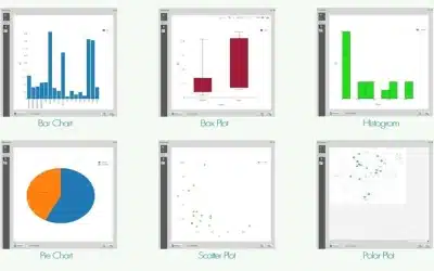
Spatial Analysis Techniques: The following analysis tasks were covered during the training – Proximity (buffering), overlay, union, clip, intersect, creating fishnets, network analysis, and geostatistical analysis.
Energy-Specific Analysis: Advanced modeling energy demand using model builder, ideal/optimal site selection for locating renewable energy (location-allocation), and optimizing energy distribution networks and models.
Cartography, Mapping & Visualization
Cartography: This is the art and science of designing and creating maps for various uses. The course covered the topics related to designing, developing and deploying effective GIS maps (both hardcopy and online) for energy utility applications such as transmission and distribution; including thematic maps, heat maps, as well as 3D visualizations.
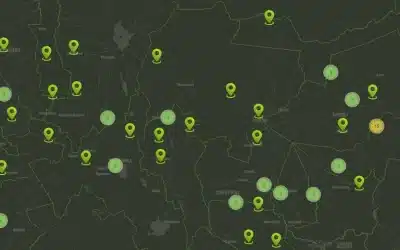
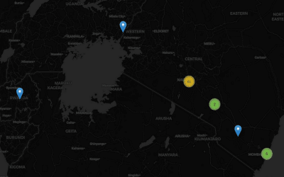
Interactive Dashboards: Designing, building and using interactive GIS dashboards and portals for real-time data sharing and visualization. Administering and maintaning GIS dashboards.
 Case Studies and Applications
Renewable Energy: Site selection for hydro-electric, wind farms, solar power potential mapping, and biomass resource mapping and assessment.
Grid Analysis: Evaluating the electrical grid infrastructure, identifying areas prone to power outages, and planning grid expansions based on customer mapping and power supply-demand analysis.
Energy Efficiency: Analyzing building energy efficiency, understanding urban heat islands, and smart city planning; understanding and overcoming energy shortages.
Advanced GIS Training Techniques
Remote Sensing/drone mapping: Utilizing the satellite and aerial/drone imagery data for energy applications such as mapping the locations of customers, creating 3D models (DEMs, DSMs and DTMs) among other applications.
Machine Learning in GIS: Applying machine learning and artificial intelligenge (AI) algorithms for predictive analysis in energy generation, transmission and distribution systems.
Big Data Integration: Handling and analyzing large energy utility datasets (e.g. high resolution drone imagery, LiDAR datasets), data integration with Internet of Things (IoT) data for smart grid analysis.
Project Work and Collaboration
Capstone Projects: The training also covered the undertaking of real-world projects in the application of GIS skills in various energy engineering contexts in the African region.
GIS Team Collaboration: Working in GIS field teams to solve complex energy challenges such as optimizing electricity distribution using GIS location-allocation modules.
Geospatial Industry Tools and Trends
Emerging Technologies: An indepth overview of the recent advancements in GIS and space technology as well as their applications in the energy sector.
GIS Industry Software: The energy engineers were exposed to the specialized and advanced tools used in the energy industry (e.g., ArcFM UT, HOMER, PVSyst).
Course Certification
GIS Training Certification: Our GIS training institution (Orbital Geospatial College) offers certificates to successful course participants. Hence, upon completion of the training, we offered GIS course certification to all the six (6) engineers.
Workshops and Seminars: The course participants were encouraged to take part in various upcoming GIS workshops, webinars, and conferences to stay updated on new developments and advancements in GIS realm.
In conclusion, GIS is not only useful in developing and deploying accurate geodatabases, improve internal efficiency levels pertaining to power supply/didtribution monitoring, commercial and customer services but also extremely useful in network analysis, facility management, energy audits, load management, theft detection among others. The GIS solutions (dashboards and online maps) provide timely, accurate and efficient way of acquiring and disseminating information, which is very vital in taking prompt and accurate decisions necessary in the economic development of any enterprise, industry or country.
Article By: Felix Orina, MISK | @felixorina
Ad: Explore the world with Expedia

Flewflew: AI solutions provider in Africa

OrbiCollect: Mobile mapping made easier!

NSE Stock Market: Buy & Sell Shares

Join Binance and Let us win together!

AGM 6th Edition: Jan-Apr 2025