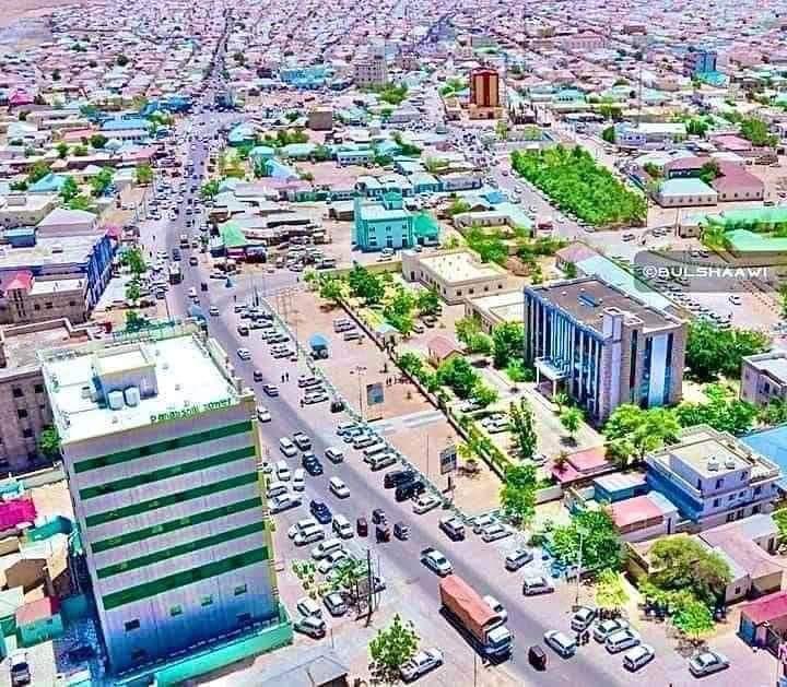
GPR scanning of underground utilities was conducted in Garowe. Garowe is the capital city of Puntland located in North Eastern part of Somalia. It serves as the administrative centre of the Nugal region and is known for its strategic political and economic importance. Garowe is strategically located on the road that connects the southern and northern parts of Somalia, making it a vital transport hub. As the administrative capital of Puntland, Garowe houses the government institutions of the state. Puntland operates as an autonomous region within Somalia, and its government is responsible for managing local affairs, security, and development initiatives. The economy of Garowe is primarily based on livestock, trade, and telecommunications. The city has seen significant growth and development over recent years, with investments in infrastructure and services.
 Garowe is home to several educational institutions, including universities and vocational training centers, which contribute to the region’s development. Healthcare services have also improved, with the establishment of hospitals and clinics. The cultural life in Garowe reflects the broader Somali traditions, with a strong emphasis on community, hospitality, and Islamic values. Various local events and festivals are part of the social fabric. Despite its development, Garowe faces challenges common to the region, such as political instability, economic constraints, and security concerns. However, the local government and international partners continue to work on initiatives to address these issues.
GPR Scanning in Garowe City
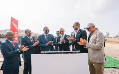
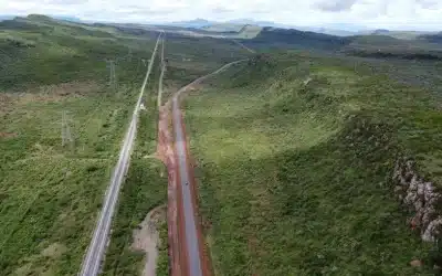
Orbital Africa was contacted and contracted by Descon Architecture and Engineering Consultancy Ltd – a company based in Mogadishu, Somalia to undertake Subsurface utility scanning and mapping within a select road network of 24 kilometres in Garowe City, Puntland region. The project was executed between 3rd – 15th of June 2024. Ground Penetrating Radar (GPR) is a non-invasive and non-destructive geophysical method used to investigate subsurface features and utilities. It uses electromagnetic waves to detect structures and objects below the earth’s surface. The GPR works by transmitting high-frequency radio waves into the ground through an antenna. When these waves encounter different subsurface materials, they are reflected back to the surface and detected by a receiver. The time it takes for the waves to return provides information about the depth and composition of the subsurface structures.
GPR Scanning Methodology
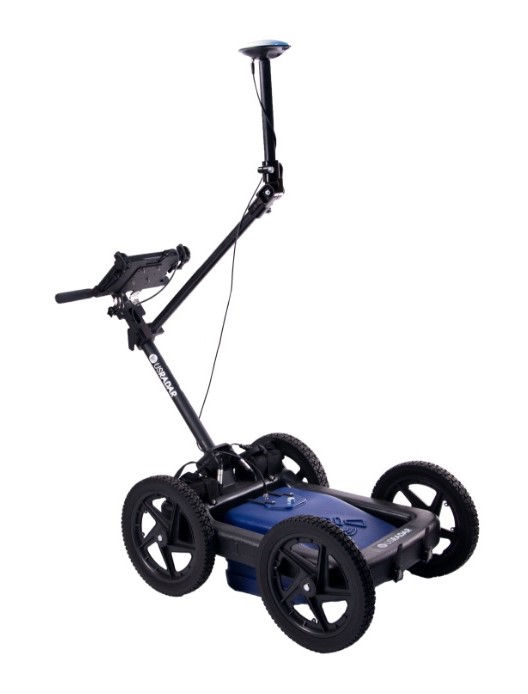
GPR Equipment: It is equipped with a transmitting antenna that sends out the radio waves and a receiving antenna that captures the reflected signals. The Control Unit controls the operation of the GPR system, processes the received signals, and displays the results in real-time. The GPR Data Storage has capability for recording the scanned data for further post-processing and analysis.
Also read about this captivating article >>> GPR Underground Utility Scanning in Dar es Salaam, Tanzania
Site Preparation: The site survey which is an initial assessment of the project loaction was done to determine the purpose of the scan, the type of subsurface features expected, and any potential obstacles. The calibration of the GPR system to the specific conditions of the site follewed, including soil type, moisture content, and expected depth of targets. The scan grid setup of entire 25 km road network was established over the entire area that was scanned, allowing systematic data collection.
 Data Collection: The GPR antenna is moved systematically over the survey grid. The antenna can be mounted on a cart, vehicle, or handheld for smaller areas. The transmitting antenna emited short pulses of radio waves into the subsurface ground. The receiving antenna captured the reflected signals at intervals depending on the scan grid size. The travel time of these signals were recorded and used to create a profile of the subsurface including all utilities.
Data Processing: The collected raw data which were in the form of radargrams, which are two-dimensional images representing the reflected signals were classified accordingly. Filtering and enhancement which is a form of signal processing techniques were applied to filter out noise and enhance the quality of the data, such as background subtraction and gain adjustments. The Time-to-Depth conversion were then done. This entailed conversion of travel time of the radar waves into depth information using the known velocity of the waves in the specific material being investigated, in this case water pipes, electric and telecommunication cables.
Results and Reporting
Interpretation and Presentation: The processed radargrams are analyzed to identify subsurface features. This included recognizing patterns that indicate objects, voids, or changes in material composition. For 3D imaging, more complex investigations encompassed collection of data from multiple scans combined to create a three-dimensional (3D) images of the subsurface structures. The comparison with other utility data from Garowe city was also done. The GPR results are often compared with data from other geophysical methods or historical records for a comprehensive understanding.
Project Reporting: The findings were documented in a detailed report that includes radargrams, interpretations, and any 3D models created. The project report prepared captured the recommendations based on the findings, such as areas requiring further investigation or specific actions to address identified subsurface issues.
Article By: Felix Orina, MISK | @felixorina
Ad: Explore the world with Expedia

Flewflew: AI solutions provider in Africa

OrbiCollect: Mobile mapping made easier!

NSE Stock Market: Buy & Sell Shares

Join Binance and Let us win together!

AGM 6th Edition: Jan-Apr 2025