Introduction
GPR technology is a non-invasive geophysical method used to investigate the subsurface. It utilizes electro magnetic (EM) waves to detect objects, utilities (cables, pipes, etc) changes in material properties, and voids or cracks beneath the surface. GPR is widely employed in archeology, construction, utilities mapping, and environmental studies. A GPR system works by transmitting high-frequency electromagnetic waves into the ground using an antenna. The frequency typically ranges from 10 MHz to 2.6 GHz, depending on the application.
When the EM waves encounter materials with different dielectric constants (e.g., soil, rock, metal, or voids), part of the signal is reflected back to the earth’s surface. The reflected signals are recorded by a receiver in the GPR system. The time it takes for the signal to return from the ground is used to calculate the depth of the reflecting object or layer. The data collection unit (often a tablet) installed with GPR software then generates 2D or 3D images of the subsurface which are further post-processed to generate maps and reports.

GPR project in Mogadishu
In December 2025, Descon contracted Orbital to execute a GPR underground utility scanning project in Mogadishu city, Somalia. The project took approximately 2 months to execute. Orbital has executed similar GPR projects in Garowe Puntland Somalia and in Dar es Salaam Tanzania. The project in Mogadishu is very critical in many ways.
Mogadishu, locally known as Xamar, is the capital and largest city of Somalia. Situated along the Indian Ocean on the eastern coast of Africa, it serves as the economic, political, and cultural hub of the nation. Mogadishu is one of Africa’s oldest cities, with a rich history that spans centuries of trade, conquest, and cultural exchange.
Mogadishu’s history dates back to at least the 9th century, when it became a prominent center of trade along the Swahili coast. Its strategic location made it a key stop for merchants from the Arabian Peninsula, Persia, India, and beyond. During the colonial era, Mogadishu fell under Italian control and became the capital of Italian Somaliland. This era left a lasting architectural influence, with a mix of Italian and Somali designs still visible in parts of the city.
1. Project Planning and Objective Definition: Executing a Ground Penetrating Radar (GPR) project requires meticulous planning, skilled operation, and careful data analysis to ensure accurate results. GPR is a versatile geophysical tool used in a range of applications such as subsurface utility mapping, archaeological investigations, structural assessments, and environmental studies. The first step in executing a GPR project was to clearly define the objectives and scope. This involved understanding the client’s needs and objectives; the type of subsurface features to be detected, and the expected depth of investigation. It was essential to consider site-specific factors such as soil type, terrain, and environmental conditions, as they significantly impact the effectiveness of GPR technology. The detailed planning ensured that the equipment, methodology, and resources were appropriately aligned with project goals.
2. Equipment Selection: Choosing the right GPR equipment was critical for project success. The frequency of the GPR antenna determines the depth of penetration and resolution of the data. For instance, high-frequency antennas (e.g., 900 MHz) are ideal for detecting shallow and fine features like rebar in concrete, while low-frequency antennas (e.g., 100 MHz) are better suited for deep subsurface exploration. Furthermore, modern GPR systems often feature multi-frequency capabilities, which can be advantageous for complex projects.
3. Site Preparation and Safety Measures: Before fieldwork began, the site preparation is crucial. This included obtaining necessary permits, ensuring site access, and marking potential hazards. Safety measures were also prioritized, including training operators to recognize and mitigate risks such as uneven terrain, buried utilities, or adverse weather conditions. Proper communication with all stakeholders, including local authorities, ensured compliance with regulations and facilitates a smooth execution process.
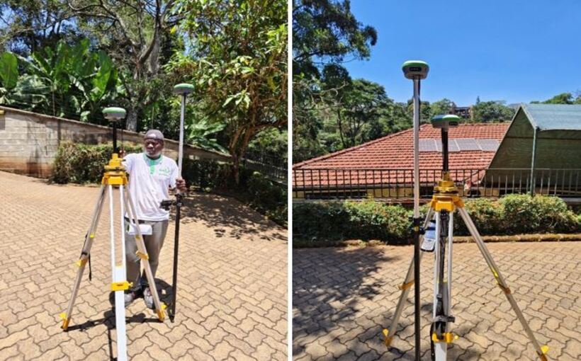
4. Data Collection and Survey Execution: GPR data collection involved systematically scanning the Mogadishu city using a GPR system. The GPR operator maintained consistent antenna movement, speed, and positioning to ensure uniform data quality. The real-time data visualization on the GPR system helped identify anomalies and refine survey techniques during field work. Accurate geo-referencing using GNSS or other positioning systems was essential for integrating GPR data with maps and GIS platforms.
5. Data Processing and Interpretation: The raw GPR data required processing to extract meaningful insights. This involved filtering noise, applying corrections, and enhancing the signal-to-noise ratio. The advanced software tools allowed for the generation of 2D profiles and 3D visualizations, enabling detailed analysis of subsurface features. Further, interpreting GPR data demanded expertise, as various factors like material properties and environmental conditions can influence the results.

6. Reporting and Deliverables: The final step in a GPR project was compiling the findings into a comprehensive report. The report included a clear description of the methodology, equipment used, and site conditions. The visualizations such as GPR profiles, depth slices, and 3D models provided valuable context regarding project scope. Highlighting key observations and recommendations ensured that the report was actionable and aligned with the client’s objectives.
7. Challenges and Mitigation Strategies: Every GPR project comes with unique challenges, such as signal attenuation in clay-rich soils, interference from surface features, or limited access to survey areas. Mitigating these challenges required a combination of experience, adaptive methodologies, and innovative solutions. For instance, combining GPR with complementary techniques like electromagnetic surveys can enhance data accuracy in challenging environments.
8. Post-Project Evaluation: After completing the project, a post-project evaluation helped identify lessons learned and areas for improvement. The feedback from stakeholders is invaluable for refining processes and ensuring future success. Evaluating the performance of the equipment, techniques, and team can guide the optimization of workflows and resource allocation in subsequent projects.
In most cases, executing a GPR project is a complex process that demands careful planning, technical expertise, and effective communication among stakeholders. By adhering to best practices and leveraging advanced technologies, GPR projects can deliver precise and actionable insights into the subsurface, making it an indispensable tool for industries ranging from construction and archeology to environmental science. With the right approach, GPR continues to be a game-changer in uncovering the hidden layers of our world.
Advancements
- 3D GPR Imaging: Produces three-dimensional visualizations of the subsurface for enhanced analysis.
- Automated Systems: Integration with drones and robots for remote or difficult-to-access surveys.
- AI and Machine Learning: Automating data interpretation to identify patterns and anomalies more efficiently.
- Higher Frequencies: Improved resolution for detailed subsurface imaging.
Limitations
- Depth Penetration: Limited by the frequency of the antenna and the material properties. High-frequency antennas provide better resolution but lower depth penetration.
- Material Dependence: Performance is affected by the material’s dielectric properties. Wet or clay-rich soils may attenuate signals.
- Complexity: GPR often requires skilled operators for data collection, processing interpretation.
- Cost: The cost of acquiring GPR hardware equipment, the data collection and post-processing software as well the operation can be expensive.
GIS training courses catalogue: Here ++ | E-mail address: [email protected] | WhatsApp No: +254 719 672 296
[/vc_column_text][/vc_column][/vc_row]


