Introduction to QGIS course
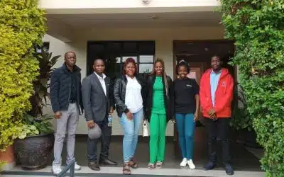
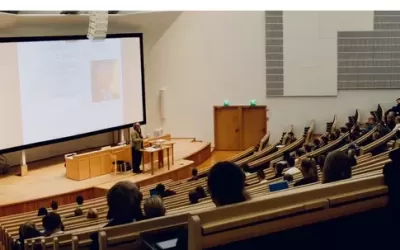
The customized QGIS applications in telecommunication industry training course was offered by Orbital Africa to a group of Telesom company engineers during the month of December 2024. This beginner to advanced course provided a comprehensive introduction to GIS, spatial analysis, and mapping using QGIS – a powerful and free open-source GIS software. Generally, the course is designed for professionals, students, and researchers keen on advancing and enhancing their geo skills. This course emphasized hands-on theoretical and practical learning delivered through face-to-face or physical mode. The duration of the QGIS training was 2 weeks.
Indeed, the Global GIS market in the telecommunication industry is one of the fastest-growing markets worldwide. The GIS mapping can revitalize telecom companies by reducing costs and enhancing better capital planning as telcos focus on infrastructure efficiency, better communication systems and GIS mapping can make a huge difference in managing assets, predicting outages and deciding where to install telecommunication infrastructure.
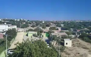
The training was conducted at Telesom premises in Hargeisa city, in the Republic of Somaliland. Hargeisa serves as the political, economic, and cultural hub of Somaliland. Hargeisa is the capital and largest city of the Republic of Somaliland. It is one of the safest and peaceful places in what the rest of the world still considers to be Somalia. According to 2023 estimates, Hargeisa has more than 1.1 million inhabitants. The city is a peaceful and friendly place, but does require some planning to ensure a successful visit. It was founded as a watering and trading stop between the coast and the interior by the Isaaq Sultanate. Initially, it served as a watering well for the vast livestock of the Isaaq clan that inhabited that specific region and later were joined by other Isaaq clans that currently inhabit the Hargeisa region.

The 2-week GIS training course was designed to cover the evolution and the basic concepts of GIS and its application in the telecom industry. The workshop covers displaying, querying, and sharing geospatial data as well as highlighting spatial capturing techniques and how to solve spatial problem in Telecom Industry. Upon successful completion of the training, the participants were be able to:
- Understand the evolution of GIS technology with its myriad of applications in telecommunications industry such as Telesom.
- Create GIS maps, infographs, reports, and other statistical presentations and for visualizing telecomms data.
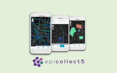
- Use smartphone technology to capture and store spatial telecommunications data in cloud Geoserver.
- Solve spatial problems in telecommunications industry e.g. locating underground fiber optic, towers, manholes etc.
- Use various tools tools and plugins to evaluate the strength and weaknesses of GIS for telecommunications data handling, analysis as well as presentation.
- Integrate and incorporate GIS techniques and workflows into the current activities of Telesom telecomms industry.
QGIS training approach
We employed a flexible training approach focusing on the level of GIS skills of the participants. Cognizant of the fact that the participants might have varying knowledge and understanding of key GIS terms and concepts, we did an assessment by use of a short survey on levels of GIS skills prior to the training. This allowed us better customize the training materials in a way that fully addressed the needs of all the trainees. The information from this survey informed the preparation of training manuals, data, slides and tools by our experienced trainers. We had also set the training pace whereby each participant was given opportunity to interact with the QGIS software tools, plugins etc whilst at the same time getting acquainted with all the advanced QGIS course contents and concepts.
QGIS training objectives
- To have a clear understanding of the principles, tools, functionalities, plugins available in QGIS as well as the analysis workflows;
- To have a clear understanding of key basic as well as advanced GIS concepts, tools and map making techniques using the QGIS software;
- To understand the nature of spatial and attribute data, analysis and management of simple to complex GIS datasets manipulation including concepts of network and land parcel management using QGIS Cadastre plugin, Google maps and OSM;
- To have theoretical and practical skills in publishing standalone and web GIS maps in various platforms;
- To learn how to integrate and utilize GIS technology in the day-to-day activities especially in data collection, analysis, management, dissemination and visualization thereof using graphical, maps and statistical tools;
- To broaden and have a wider scope on various tools available for GIS field, office and online as well develop in-depth skills on how to use python programming i.e. PyQGIS.
The main and specific purpose of this consultancy was to train the Telesom engineers on the use of QGIS platform in managing telecommunications infrastructure as well as land asset, focusing on the following specific modules: Data collection – mobile based tools; Data synchronization, processing and editing in QGIS; Basic and advanced spatial analysis using tools such as buffer, clip, dissolve, symmetrical difference, intersect, Thiessen polygons among others; design and administration of spatial databases; design and creation of maps, charts, infographs statistical reports etc; data dissemination using hardcopy and online GIS for real time data visualization.
Why train with us?
We employ very flexible training approaches focusing on and assessing the level of GIS skills the participants have prior to training. In various organizations, the staff members may have varying skills, knowledge and limited understanding of key GIS terms and concepts. Hence, our training approach majorly focuses on instructor-trainee mode i.e. interactive with time allocated for question-and-answer sessions. Some of the key benefits of choosing Orbital Geospatial College as a premier provider of GIS training services provider in Kenya and Africa region include but not limited to:

- Online GIS training platform (http://e-learning.ogc.or.ke/) which will enable participants to access the additional training to further their GIS skills in future.
- Our training materials are of high standards and are customized to suit local and user needs.
- We have a reputation for excellence and efficiency in GIS training service delivery.
- Technical support is extended upon completion of training.
- Our course content is updated continuously and development of new programs is on-going.
- Our courses focus on practical needs of the professionals & the industries in which they work.
- The courses will provide you with practical tools/techniques that can be used immediately.
- Our course instructors are highly skilled professionals who combine academic expertise (With PhD and MSc. degrees in GIS and mapping) with significant industry experience.
Indeed, the 21st century has so far been an era of colossal technological advances in AI, robotics, big data, drone technology among others. Consequently, Geospatial data has played a crucial role in this age of technology disruptions. To be at pace with these changes, it’s imperative for all of us from virtually every field to get acquainted with advances in GIS, through learning and capacity development. This will facilitate and enhance better decision making for building resilient infrastructure to ensure sustainable industrialization and fostering of innovation for sustainable development. For more information about our GIS training courses, please refer to the details below.
GIS training courses catalogue: Here ++ | E-mail address: [email protected] | WhatsApp No: +254 719 672 296
Article done by: Felix Orina and Orbital training team. Happy 2025 to our esteemed clients in Kenya & across the globe!


