Orbital Geospatial College recently conducted a comprehensive two-week professional training on Applications of GIS and Remote Sensing for Planning, Monitoring & Evaluation (M&E), Disaster Risk Management, and Fiber Optic Cabling for six directors from the Ministry of Information and Communication (MICT), Somaliland. The training was hosted at Orbital Geospatial College, located in Karen, from 20th April to 1st May 2026. This high-level capacity-building program was tailored to strengthen institutional expertise in leveraging geospatial technologies for strategic planning, infrastructure development and national resilience.
Course Content Overview
The training was structured into focused modules, each aligned with real-world government applications:
- Fundamentals of GIS
- Spatial data types (vector and raster data)
- Coordinate systems and map projections
- Geodatabase design and data management
- Map creation and cartographic visualization
- Remote Sensing & Earth Observation
- Satellite imagery sources and resolutions
- Image preprocessing and enhancement
- Land use/land cover classification
- Change detection and time-series analysis
- GIS for Planning
- Land use and urban planning analysis
- Site suitability modeling
- Infrastructure mapping and spatial decision support
- Multi-criteria analysis for policy planning
- Monitoring & Evaluation (M&E) using GIS
- Designing spatial indicators and KPIs
- GIS dashboards and reporting tools
- Project tracking and performance mapping
- Data-driven evaluation frameworks
- Disaster Risk Management (DRM)
- Hazard identification and mapping
- Vulnerability and exposure analysis
- Risk modeling and scenario simulation
- Early warning systems and emergency response planning
- Fiber Optic Cabling & Network Planning
- GIS-based fiber route design and optimization
- Terrain and right-of-way analysis
- Mapping existing telecom infrastructure
- Network scalability and cost minimization strategies
The course was designed to provide both foundational knowledge and advanced practical skills in Geographical Information Systems (GIS) and remote sensing. The participants were introduced to core GIS concepts including spatial data models, coordinate systems, geodatabases and map design principles. Through the hands-on exercises, they learned how to collect, manage, analyze, and visualize spatial data using industry-standard tools such as Kobotoolbox, OrbiCollect, Survey123 etc. The remote sensing component focused on satellite imagery interpretation, image classification techniques, change detection, and the use of earth observation data for environmental and infrastructure monitoring.

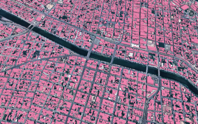
A key focus of the training was the application of GIS in planning and decision-making processes. The participants explored how spatial analysis can support land use planning, urban development and resource allocation. They were trained on how to integrate multiple data layers—such as population, infrastructure, terrain, and environmental factors—to generate actionable insights. This approach enables government institutions to move toward data-driven planning, improving efficiency and transparency in project implementation.
In the Monitoring and Evaluation (M&E) module, the training emphasized the use of GIS as a powerful tool for tracking project performance and outcomes. The participants learned how to design spatial indicators, develop dashboards and use geospatial data to monitor progress in real time. By integrating GIS into M&E frameworks, institutions can better assess the impact of development initiatives, identify gaps, and make timely adjustments to improve results.
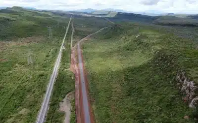
The Disaster Risk Management (DRM) was another critical component of the program. The participants were trained on hazard mapping, vulnerability assessment, and risk modeling using GIS and remote sensing data. They explored how satellite imagery is used to detect and monitor natural hazards such as floods, droughts, and land degradation. The practical sessions included creating risk maps, identifying high-risk zones, and developing early warning systems. These skills are essential for enhancing preparedness, response, and recovery efforts, particularly in regions prone to climate-related risks.
The fiber optic cabling module provided specialized training on the role of GIS in telecommunications infrastructure planning and deployment. The participants learned how to design fiber optic networks using spatial data, including route optimization, terrain analysis, and right-of-way planning. They were also introduced to tools for mapping existing infrastructure, identifying optimal cable paths, and minimizing deployment costs. The integration of GIS in fiber network planning ensures more efficient and scalable connectivity solutions, which are vital for digital transformation and economic growth.

Throughout the training, emphasis was placed on real-world applications and case studies relevant to Somaliland’s development context. The participants engaged in group projects and scenario-based exercises that simulated actual planning and decision-making challenges. This practical approach ensured that the knowledge gained could be directly applied within their respective departments and projects.
The training also fostered knowledge exchange and collaboration among participants, creating a platform for sharing experiences and best practices. By bringing together senior-level directors, the program strengthened leadership capacity and promoted a unified approach to adopting geospatial technologies across government sectors.
At the conclusion of the training, participants demonstrated a strong grasp of GIS and remote sensing applications and expressed confidence in applying these tools to support their institutional mandates. The program not only enhanced technical skills but also reinforced the strategic importance of geospatial intelligence in modern governance.
This initiative by Orbital Geospatial College reflects its commitment to building regional capacity in geospatial technologies and supporting governments in harnessing the power of data for sustainable development. As countries increasingly adopt digital solutions, such training programs play a critical role in equipping decision-makers with the tools needed to plan effectively, respond to challenges, and drive innovation.

All the participants were issued with certificates upon completion of the GIS training. The photo session incorporating the participants and Orbital Geospatial College staff followed thereafter.
By empowering government officers from Somaliland with advanced GIS and remote sensing capabilities, the training marks a significant step toward strengthening institutional frameworks, improving service delivery, and fostering resilient, data-driven development in the country and region at large.
GIS training courses catalogue: Here ++ | E-mail address: [email protected] | WhatsApp No: +254 719 672 296
Ad: Explore the world with Expedia

Flewflew: AI solutions provider in Africa

OrbiCollect: Mobile mapping made easier!

NSE Stock Market: Buy & Sell Shares