Ground Control Points
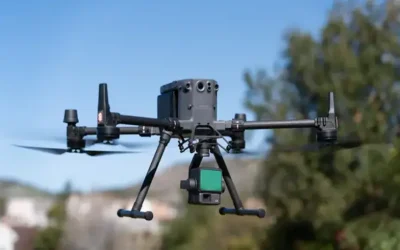
Ground control points (GCPs) and check points are used in the field of photogrammetry and remote sensing to improve the accuracy of geospatial data products created from aerial imagery. The GCPs play an important role in ensuring the accuracy of drone surveys. They are used to “tie” the drone imagery to the ground, which is necessary for accurate georeferencing of the final output.
 GCPs are physical markers placed on the ground that have accurately known positions in the coordinate system of the map or survey being created. GCPs are typically placed on the ground at known locations and their positions are surveyed using high-precision GPS equipment. During the drone survey, the drone captures aerial imagery that includes the GCPs. The location of the GCPs in the drone imagery is then determined using photogrammetric software. This process involves matching the positions of the GCPs in the drone imagery with their known positions on the ground.
By accurately georeferencing the drone imagery to the ground using GCPs, the final output, such as a digital elevation model (DEM), digital terrain model (DSM) or orthomosaic, can be produced with a high degree of accuracy. The number and spacing of GCPs required for a drone survey will depend on several factors, including the desired level of accuracy, the size and complexity of the survey area, and the quality of the drone’s GPS positioning system. Typically, a minimum of three GCPs are required for accurate georeferencing, but more GCPs may be needed for larger survey areas or higher levels of accuracy.
Ground Check Points
Check points, on the other hand, are similar to GCPs but are used to evaluate and validate the accuracy of the geospatial data products after they have been created. Check points are additional markers placed on the ground that are also surveyed with high-precision GPS equipment and their positions are measured. These check points are not used to calculate the aerial imagery output but they are used to measure the accuracy of the output.
Like ground control points (GCPs), check points are physical markers placed on the ground with accurately known positions in the coordinate system of the map or survey being created. They are typically placed at locations that are not used as GCPs, and their positions are surveyed using high-precision GPS equipment.
After the drone survey is completed, the positions of the check points in the output are measured and compared to their known positions on the ground. The difference between the measured and known positions of the check points is used to calculate the accuracy of the final output. Check points provide an objective measure of the accuracy of the output and help to ensure that the drone survey meets the required accuracy standards for the intended application. They can also help to identify and correct any errors or inconsistencies in the drone survey or the processing of the imagery.
The number and spacing of check points required for a drone survey will depend on several factors, including the desired level of accuracy, the size and complexity of the survey area, and the quality of the drone’s GPS positioning system. Typically, a minimum of two to three check points are required for accurate validation of the output, but more check points may be needed for larger survey areas or higher levels of accuracy.
Why GCPs and Check Points?
The process of using GCPs and check points is called ground truthing. The placement and measurement of GCPs and check points helps to improve the accuracy of the final product and provides a means to validate the accuracy of the photogrammetry results. The accuracy of the geospatial data products can be quantified by comparing the known positions of the GCPs and check points with their measured positions in the output. This helps to ensure that the geospatial data products meet the required positional accuracy standards for the intended mapping application.
Ad: Explore the world with Expedia

Fliki: Turn your ideas into videos

AGE 2025 Expo and conference

Join Binance and Let us win together!

AGM 6th Edition: Jan-Apr 2025