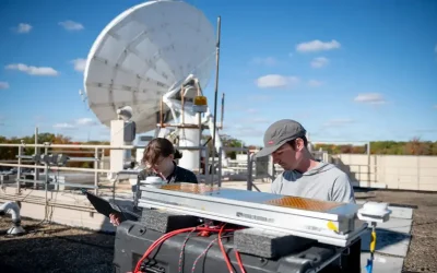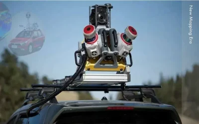
The Lixel X1 Handheld Simultaneous Localization And Mapping (SLAM) Scanner by SatLab Geosolutions is a versatile and powerful 3D scanning device designed for various applications such as topographic mapping, agriculture, forestry surveys, engineering surveys, volume calculations, emergency mapping, and underground utility as well as space mapping. Lixel X1 real scene 3D reconstruction scanner is a compact, powerful, and precise LiDAR scanner for capturing real-world scenes and generating detailed 3D models instantly without post-processing. Powered by advanced SLAM technology, this lightweight and integrated device offers real-time data capture and immediate data preview.
Key features of the Lixel X1 include:
-
Real-Time Data Capture: Utilizing advanced SLAM (Simultaneous Localization and Mapping) technology, the scanner provides immediate data capture and reconstruction, enabling real-time preview of the scanned environment. This feature eliminates the need for post-processing, significantly speeding up workflows.
- Integrated Design: The scanner combines a LiDAR sensor, visible-light camera, motion camera, high-precision inertial navigation, and high-performance computing into a compact, lightweight unit (weighing less than 1.9 kg). This integrated design simplifies operation and enhances the device’s heat-sinking capability, making it efficient and user-friendly.
- Operational Efficiency: The Lixel X1 can operate continuously for up to 60 minutes and has the capability to resume scanning from breakpoints, which is beneficial for large-scale or segmented projects. This ensures high efficiency in measurement and data analysis.
-
Flexible Mounting Options: The scanner can be mounted on a variety of platforms, including backpacks, vehicles, and UAVs (unmanned aerial vehicles), making it suitable for a wide range of field conditions and applications.
Technical Specifications:
-
Dimensions: 138 x 90 x 381 mm
- Weight: <1.9 kg (including battery)
- Power Consumption: <30W
- Operational Range: 0.05 – 120 m
- Point Cloud Data Rate: 320,000 points per second
- Accuracy: <2 cm
- Field of View (FOV): 360 x 270 degrees
- Battery Life: Approximately 1.5 hours
- Continue Reading >>>
Why consider Lixel X1 3D Scanner?
1. Fast Capturing & Real Time Modelling: Utilizing real-time data decoding and modeling technology, point cloud data is immediately generated within a mere 5 seconds inside the precise LiDAR scanner right after scanning. This allows for the immediate monitoring of reconstruction effects in the LixelGo software, ensuring high-quality data.
2. Integrated Design: Lixel X1’s integrated design of LiDAR, visible-light camera, motion camera, high-precision inertial navigation technology, and high performance computing eliminates the tedious operation steps and makes your scan easier and simple. And the complex structure is of excellent heat-sinking capability.
3. Continuous Operation & Breakpoint Scanning: 60 minutes of ultra-long continuous operation time and high capability in resuming the scanning from the break-point. No need for segmented scanning in large scenes and greatly improves the efficiency of measurement and data analysis.
4. Multi-platform Brackets: In addition to being portable, the LiDAR scanner Lixel X1 can be attached to a backpack, a vehicle and UAV. The flexibility makes the Lixel X1 a flexible mobile mapping solution in a variety of working locations.
Also read this captivating article: Reinventing Survey with FJD Trion P1 Mobile 3D Laser Scanner
Lixel X1 is a powerful 3D scanner that combines LiDAR, visible-light and motion cameras, and high-precision inertial sensing with SatLab’s next-generation SLAM technology. Data and scene reconstruction can be previewed in real time, and can be exported immediately after scanning without the need for post-processing, simplifying workflows and enhancing efficiency. The versatile system enables scans to be easily resumed from breakpoints, allowing surveys to be broken up into convenient segments.
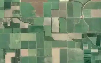
Applications of Lixel X1 3D Scanner
- Topographic Mapping
- Agriculture & Forestry Survey
- Engineering Survey
- Volume Calculation
- Emergency Mapping
- Underground Space
Ad: Explore the world with Expedia

Flewflew: AI solutions provider in Africa

OrbiCollect: Mobile mapping made easier!

NSE Stock Market: Buy & Sell Shares