A GIS Incidents Reporting Platform is a software application that allows users to report and track incidents on a geographic information system (GIS). It is a software system that allows organizations and individuals to collect, manage, and analyze data related to incidents or events that have a geographic component. These platforms leverage the power of GIS technology to provide spatial context to incidents, making it easier to understand their distribution, trends, and impacts.This type of platform can be used by a variety of organizations, including public safety agencies, transportation departments, utility companies, and businesses.
Key components of the platform
-
Data Collection: Users can report incidents or events using various methods, such as web forms, mobile apps, or even through integration with other systems. These reports can include text descriptions, photos, and location information.
-
Geospatial Integration: The platform integrates with GIS data and maps, allowing users to pinpoint the exact location of the incident on a map. This is crucial for understanding spatial patterns and relationships.
-
Data Storage: Incident data is stored in a database, which can be both spatial and non-spatial. This allows for efficient data retrieval and management.
-
Data Analysis: GIS tools enable users to perform spatial analysis on incident data. This can include clustering analysis to identify hotspots, spatial correlation analysis to find relationships between incidents and environmental factors, and trend analysis to understand incident patterns over time.
-
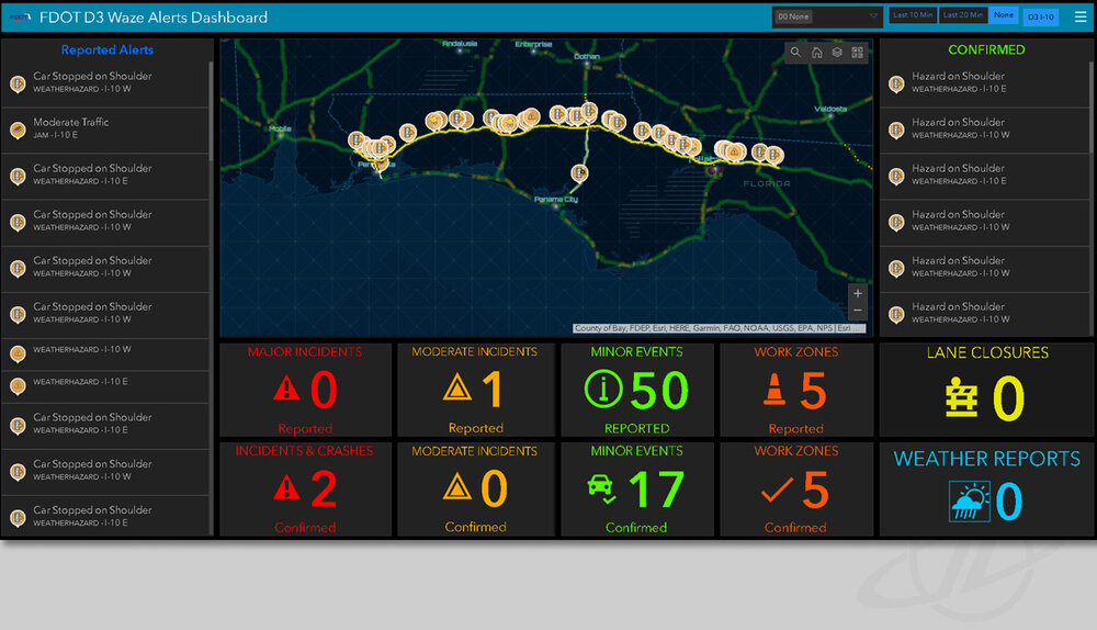
Reporting and Visualization: Users can generate reports and create interactive maps and dashboards to visualize incident data. This helps in making data-driven decisions and communicating findings effectively.
-
Alerts and Notifications: The platform can be set up to send alerts and notifications to relevant stakeholders when certain types of incidents occur or when specific conditions are met.
-
User Management: Access control and user roles are essential for ensuring that only authorized personnel can input, view, or edit incident data.
-
Integration with Other Systems: The platform can integrate with other systems, such as emergency response systems, environmental monitoring systems, or public safety databases, to provide a comprehensive view of incidents.
-
Historical Data: Storing historical incident data allows for trend analysis and long-term planning.
-
Scalability: The platform should be scalable to handle large volumes of incident reports and data.
-
Security: Strong security and safety measures/mechanisms are essential to protect sensitive incident data.
-
Mobile Accessibility: Mobile apps or a responsive web interface should be available for users in the field to report incidents in real-time.
GIS Incidents Reporting Platforms typically provide the following features:

- Incident reporting: Users can report incidents by entering a brief description, location, and other relevant information.
- Incident tracking: The platform tracks the status of each incident, including when it was reported, when it was assigned to a responder, and when it was resolved.
- Incident visualization: The platform uses GIS to visualize incidents on a map, making it easy to see where they are located and how they are distributed.
- Incident analysis: The platform can be used to analyze incident data to identify trends and patterns. This information can be used to improve incident response and prevention efforts.
GIS Incidents Reporting Platforms can be used to report a wide variety of incidents, including:
- Crime mapping;
- Traffic accidents;
- Flooding and water leakages;
- Power outages;
- Road accidents/incidents;
- Utility outages;
- Environmental hazards;
- Public health hazards;
- Business disruptions.
GIS Incidents Reporting Platforms can be a valuable tool for organizations that need to track and respond to incidents in a timely and efficient manner. By using GIS to visualize and analyze incident data, organizations can make better decisions about how to allocate resources and improve incident response.
——-
Also read this interesting article on: Automating and customizing GIS workflows with R and Python
——
Here are some specific examples of how GIS Incidents Reporting Platforms are being used in different industries:
- Public safety: Police departments, fire departments, and emergency medical services (EMS) agencies are using GIS Incidents Reporting Platforms to track crime, traffic accidents, and other emergencies. This information can be used to improve response times and allocate resources more efficiently.
- Transportation: Transportation departments are using GIS Incidents Reporting Platforms to track traffic accidents, congestion, and other disruptions. This information can be used to improve traffic flow and inform motorists about road conditions.
- Utility companies: Utility companies are using GIS Incidents Reporting Platforms to track power outages, water main breaks, and other service disruptions. This information can be used to prioritize repairs and notify customers about outages.
- Businesses: Businesses are using GIS Incidents Reporting Platforms to track incidents such as customer complaints, product recalls, and workplace accidents. This information can be used to identify trends and patterns, and to improve operations and safety.
- Environmental Monitoring: Tracking environmental incidents such as oil spills, wildfires, or pollution events.
- Healthcare: Monitoring disease outbreaks and healthcare-related incidents.
- Transportation: Reporting and managing traffic accidents, road closures, and transportation-related incidents.
- Natural Disasters: Tracking and responding to natural disasters such as hurricanes, earthquakes, and floods.
- Utilities: Managing incidents related to utilities, such as power outages or water supply issues e.g. water leakages etc.
GIS Incidents Reporting Platforms are a powerful tool that can be used by organizations of all sizes to improve their incident response and prevention efforts.
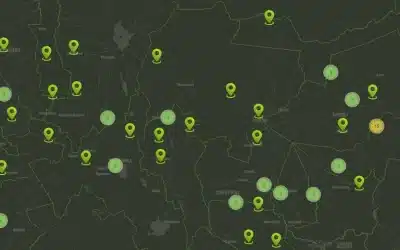
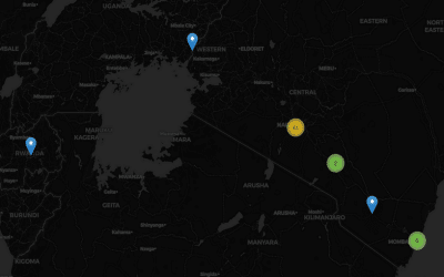
Here is a sample Orbital GIS-based incidents reporting platform
Ad: Explore the world with Expedia

Flewflew: AI solutions provider in Africa

OrbiCollect: Mobile mapping made easier!

NSE Stock Market: Buy & Sell Shares