The OrbiCollect software is a modern and robust mobile data collection platform designed for organizations, researchers, and field teams who need to gather, manage, and analyze spatial and survey data in real time. OrbiCollect data collection software powers better decisions and is designed with security, data quality, interoperability and offline functionality in mind, transforming what data can do for your organization. This solution has been designed and developed by Orbital Tech team based in Nairobi, Kenya.
OrbiCollect is trusted by thousands of organizations in over 100 countries across the globe to power high-quality mobile, field, and offline data collection, extend resources, and quicken time to impact. As a comprehensive mobile and web application designed to simplify and streamline the process of data collection, it allows users to access the app through both mobile apps and web browsers. The mobile app is available for both iOS and Android.

OrbiCollect: High-quality data collection
Built to work in every situation:Whether you need to collect data in the field with no internet connectivity or build and send web surveys quickly, OrbiCollect:
- Powers online, offline, field, and mobile data collection enabling you to dynamically collect data with ease.
- Enables easy form creation via our online form designer, XLS, and more options.
- Empowers teams from the office to the field to quickly deploy, update, and automate workflows.
Heighten security with sophisticated data protection: We take data security very seriously! No matter your use case, our SOC-2 certified, GDPR-compliant platform gives you the means to protect your data with:
- Secure Sockets Layer (SSL) and end-to-end encryption
- Password requirements to access surveys
- Integrated with Seamless single-sign-on (SSO)
Get up and running, at your own pace: Designed for fast adoption, we empower teams of all sizes and resources to get up and running quickly with:
- Professional services and 24/7 access to technical support
- No- to low-code ways to build data collection forms
- Pre-built and easy-to-customize form templates and workflows from our Hub repository
Configurable for all kinds of data workflows: Our interoperable and extensible platform makes it easy to have complete control over the look and feel of your forms as well as easy export of data via downloads, integrations, or APIs. Get:
- Field plug-ins that give you the ability to fully customize how forms look and operate
- Effortless integrations into platforms like PowerBI, Salesforce, Stata, R, and so much more
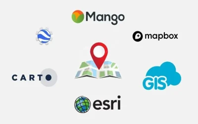
- Easy data import/export into the systems you use most e.g. ArcGIS, QGIS, Google Earth or SPSS.
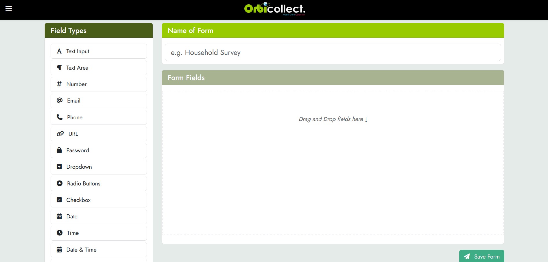
Form builder
At the core of OrbiCollect is its form builder—a dynamic web-based interface that lets users create custom forms without writing code. The users can define various field types like text, dropdowns, radio buttons, dates, checkboxes, photos, and GPS fields. Each form can be tailored to a specific data collection mission and linked to individual projects or departments. Once published, these forms can be deployed directly to mobile devices.

Additionally, with our drag and drop form builder you can now speed up form development whilst integrating it into any application and allow your users to create complex forms with ease.
The drag and drop form or questionnaire builder a user-friendly tool that allows users to create online forms by simply dragging and dropping elements like text fields, dropdown menus, and checkboxes into a visual interface. This eliminates the need for coding and makes form creation accessible to both developers and non-developers.
Forms
You can quickly convert the paper forms or questionnaires into digital forms that can be used for mobile data collection and case management. You can create multiple forms in our drag-and-drop builder (website at OrbiCollect) or using the mobile phones (Android or iOS).
Share forms with your team
The solution enables you to swiftly share the data collection forms or questionnaires using the shareable links or via the QR codes. This streamlines data collection and enables you to monitor data inflow from the field as well as monitor the project progress as well as the frequency. Just as a demo, scan the QR code below to access one of our forms.

OrbiCollect mobile app
The Orbicollect mobile app for OrbiCollect platform is optimized for Android and iOS. It enables real time and offline data collection. This means field agents can continue capturing data even in remote areas without internet access. When connectivity is restored, all locally saved submissions sync automatically to the cloud, ensuring no data is lost and improving reliability for remote fieldwork.
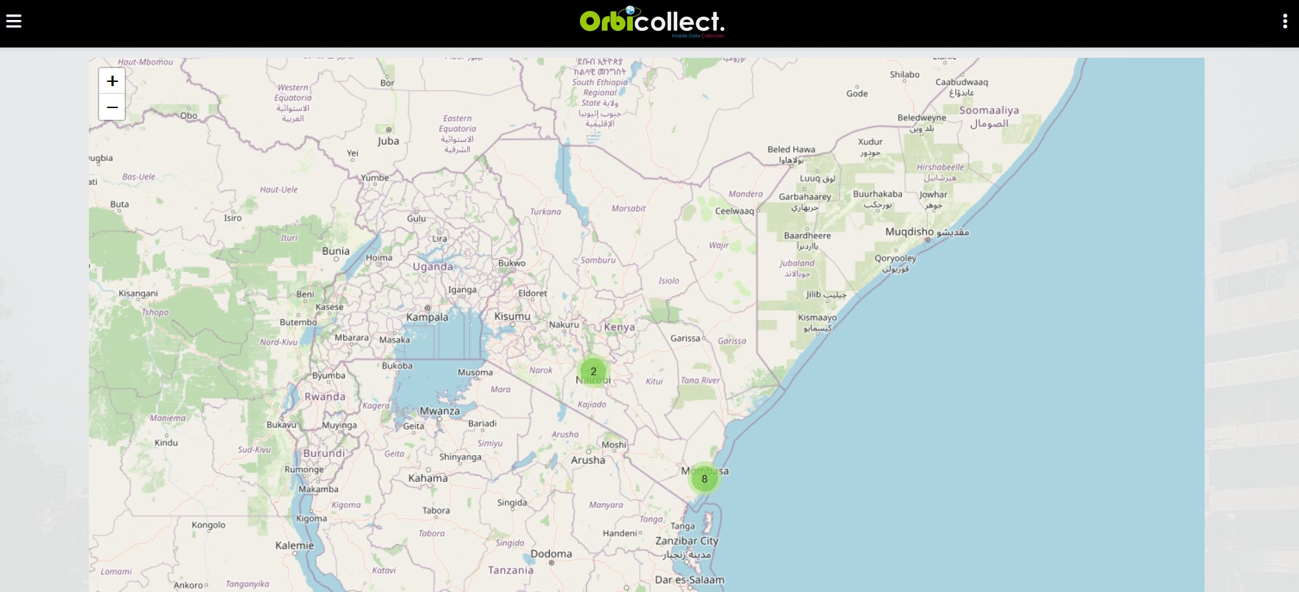
Geolocation
One of the key features of OrbiCollect is real-time geolocation tagging. Every submission can capture GPS coordinates, which are then used to plot entries on an interactive map. This allows users to view the geographical spread of their data, track patterns, and detect clusters of activity or concern. The GPS accuracy levels are also visually displayed in the app to help users ensure data precision and accuracy.
Media
OrbiCollect supports multimedia evidence capture by allowing up to ten photo uploads and two videos per submission. This makes it suitable for evidence-based reporting, field inspections, incident documentation, or monitoring infrastructure projects. The photos and videos can be previewed, reordered, or removed before submission, ensuring that only relevant data is uploaded.
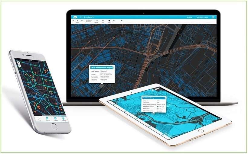
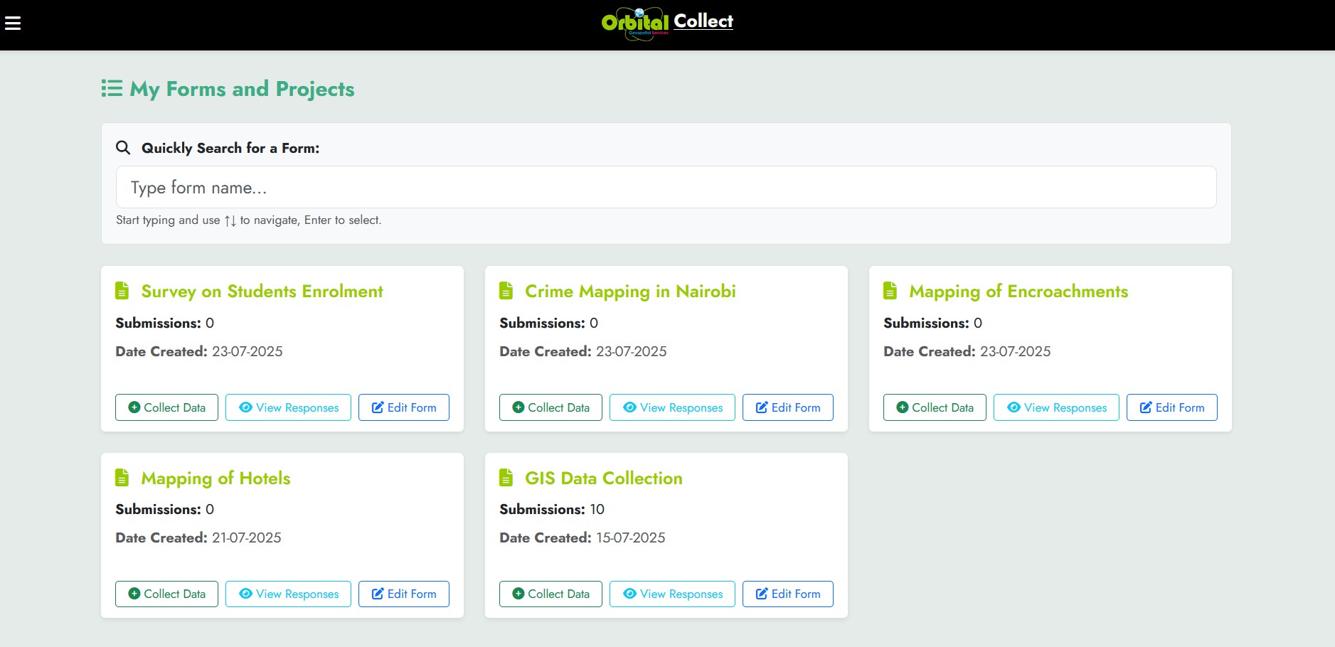
Dashboard
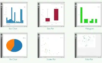
The interactive web based dashboard offers a centralized view of all collected data. Th admins can view submissions by date, project, or user, and export data in CSV, Excel, KML, SPSS or PDF formats. There are also built-in analytics features, including charts, maps, heatmaps, and submission counts. This empowers decision-makers with timely insights from the field, even before the data is fully analysed or processed.

The user management in OrbiCollect is role-based. The admins can register new users, assign roles (e.g., data collector, supervisor, manager etc), and monitor user activity. This ensures accountability and a clear chain of data responsibility, especially in large teams or government deployments. The user login includes email/password access and may be enhanced with future multi-factor authentication.
The app is built with scalability in mind. Whether you’re a small NGO running a single campaign or a national agency managing hundreds of users across multiple counties, OrbiCollect adapts to your needs. It’s built using PHP, MySQL, PostgreSQL, PostGIS, AJAX, JS and Leaflet.js for mapping, as well as Bootstrap for responsive design—offering a lightweight yet powerful backend.
Security is a core concern for OrbiCollect. All user-submitted data is securely stored in a backend database with restricted access controls. Each submission is timestamped and tagged with a unique identifier for easy tracking. The uploaded photos and documents are stored securely and linked to their corresponding data records.
Indeed, OrbiCollect bridges the gap between digital data collection and actionable insights. By enabling fast, geotagged, and media-rich submissions through a user-friendly interface, it empowers organizations to make informed decisions based on reliable field data. As the app evolves, planned features include AI-based validation, form logic, PDF report generation, and integration with external GIS platforms.
OrbiCollect Dashboard: https://orbitalafrica.com/orbicollect/
OrbiCollect Mobile App: https://orbitalafrica.com/orbicollect/android/oc.apk
Technical Support: Tel/WhatsApp: + 254 719 672296 or E-mail: [email protected]
[/vc_column_text][/vc_column][/vc_row]
Ad: Explore the world with Expedia

Flewflew: AI solutions provider in Africa

OrbiCollect: Mobile mapping made easier!

NSE Stock Market: Buy & Sell Shares

Join Binance and Let us win together!

AGM 6th Edition: Jan-Apr 2025