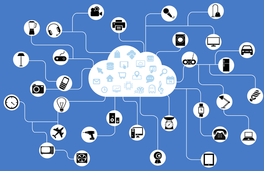
 Real-Time Data and Sensor Networks: The proliferation of sensor networks and Internet-connected devices will generate vast amounts of real-time spatial data. Geographical Information Systems will play a crucial role in integrating and analyzing this data to monitor environmental conditions, manage infrastructure, and support decision-making processes.
Introduction
 A Geographical Information System (GIS) is a computer system for capturing, storing, analysing, and displaying data related to positions on Earth’s surface. By relating seemingly unrelated data, it can help individuals and organizations better understand spatial patterns, trends and relationships in geographic context. It can use any information that includes location. In GIS, the location can be expressed in many different ways using latitude and longitude, address, or ZIP code. It is a system that creates, manages, analyzes, and maps all types of data (spatial and non-spatial). It connects data to a map, integrating location data (where things are) with all types of descriptive information (what things are like there). According to Esri, GIS provides a foundation for mapping and analysis that is used in science and almost every industry.
Brief history about GIS
The foundations of GIS can be traced back to the early 1960s when researchers began exploring the use of computers for spatial analysis. Roger Tomlinson is often considered the “Father of GIS” for his pioneering work on the Canada Geographic Information System (CGIS) in the late 1960s, which involved digitizing maps to analyze and manage natural resources. Throughout its history, Geographical Information Systems has evolved from a specialized tool used primarily by geographers and cartographers to a mainstream technology with applications in almost every sector, industry and discipline. Its continued evolution is driven by advancements in technology, data availability, and interdisciplinary collaboration, making it an indispensable tool for understanding and managing our increasingly complex and interconnected world.
 In the 1980s, commercial GIS software began to emerge, enabling users to store, analyze, and visualize geographic data more effectively. Esri (Environmental Systems Research Institute) released ARC/INFO in 1982, which became one of the most widely used GIS software packages. The 1990s saw a rapid expansion of GIS technology across various sectors. The development of more user-friendly software, increased computing power, and advances in satellite data collection technologies (such as GPS and remote sensing) contributed to the widespread adoption of GIS.
The advent of the internet and web-based GIS platforms in the 2000s revolutionized the accessibility and usability of GIS. The platforms such as Google Maps and Google Earth made geographic information more accessible to the general public, while web-based GIS applications enabled collaborative mapping and data sharing. The proliferation of smartphones and mobile devices in the 2010s led to the development of mobile GIS applications and location-based services. These applications allow users to collect, analyze, and share geographic data in real-time, transforming field data collection and asset management workflows.
In recent years, Geographical Information Systems has been increasingly integrated with big data analytics and artificial intelligence (AI) techniques. This integration enables users to perform advanced and accurate spatial analysis, predictive modeling as well as real-time decision support across various domains, including urban planning, transportation, agriculture, public health, and environmental management. In the coming years, GIS will integrate with myriad of emerging technologies.
Components of GIS
GIS technology combines common database operations like querying and statistical analysis with the unique visualization and geographic analysis benefits provided by maps. A functional GIS consists of five major components:
Hardware: The computer on which a GIS runs is referred to as its hardware. GIS software now runs on a variety of hardware platforms, ranging from centralized computer servers to desktop computers used in standalone or networked configurations.
%20Components.PNG) Software: This includes the functions and tools required to store, analyse, and display geographic data. The important software components include: tools for entering and manipulating geographic data; a database management system (DBMS); and tools for geographic query, analysis, and visualization. A graphical user interface (GUI) allows for quick access to tools.
Software: This includes the functions and tools required to store, analyse, and display geographic data. The important software components include: tools for entering and manipulating geographic data; a database management system (DBMS); and tools for geographic query, analysis, and visualization. A graphical user interface (GUI) allows for quick access to tools.
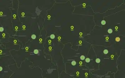
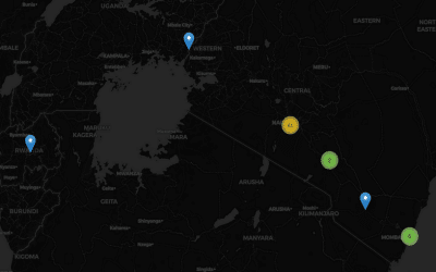
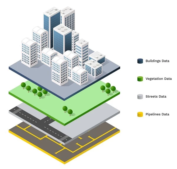
Data: The data is possibly the most important aspect of a GIS. Geographic data and related tabular data can be gathered in-house or obtained from a commercial data provider. A GIS will integrate spatial data with other data resources and can even manage spatial data using a DBMS, which is used by most organizations to organize and maintain their data.
People: Without the people who manage the system and develop plans for applying it to real-world problems, GIS technology has limited value. GIS users range from technical specialists who design and maintain the system to those who use it in their daily work.
Methods/Procedures: A successful GIS follows a well-designed plan and business rules, which are the models and operating practices that are specific to each organization.
The future of GIS
Applications and use
Geographical Information Systems is a powerful tool used across various fields for analyzing, interpreting, and visualizing spatial data. Here are some of its applications:
-
Urban Planning: Geographical Information Systems is extensively used in urban planning to analyze demographic data, land use patterns, transportation networks, and infrastructure development.
- Environmental Management: It helps in monitoring and managing natural resources, tracking environmental changes, assessing ecological impacts, and planning conservation efforts.
- Disaster Management: It plays a crucial role in disaster preparedness, response, and recovery by providing real-time data on hazards, vulnerable populations, evacuation routes, and resource allocation.
-
Public Health: It aids in disease surveillance, tracking the spread of infectious diseases, identifying high-risk areas, and planning healthcare services and facilities.
-
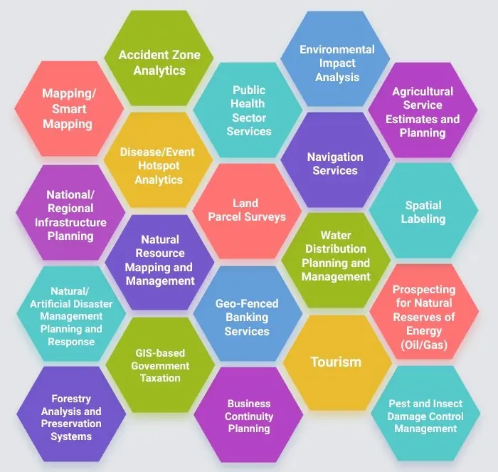 Natural Resource Management: It is used in forestry, agriculture, water resource management, and mining for inventorying resources, optimizing land use, and monitoring environmental impacts.
 - Transportation Planning: It assists in designing efficient transportation systems, analyzing traffic patterns, optimizing routes, and planning public transportation networks.
- Telecommunications: It helps telecommunications companies in network planning, site selection for towers, optimizing coverage areas, and analyzing customer demographics.
- Archaeology and Cultural Heritage: It is employed in archaeological research for site mapping, landscape analysis, and heritage preservation.
- Real Estate and Property Management: Utilized for site selection, market analysis, property valuation, and land parcel management in the real estate sector.
- Crime Mapping and Analysis: Law enforcement agencies use Geographical Information Systems for crime mapping, hotspot analysis, resource allocation, and crime prediction to enhance public safety.
- Insurance and Risk Assessment: Geographical Information Systems is used by insurance companies for risk assessment, disaster modeling, and determining insurance premiums based on factors such as proximity to hazards etc.
-
Tourism and Recreation: It assists in destination planning, route optimization, tourism marketing, and management of recreational areas by analyzing visitor flows and spatial preferences.
Register Now >>> Introduction to Geographical Information System (GIS) and Mapping
Ad: Explore the world with Expedia

Flewflew: AI solutions provider in Africa

OrbiCollect: Mobile mapping made easier!

NSE Stock Market: Buy & Sell Shares