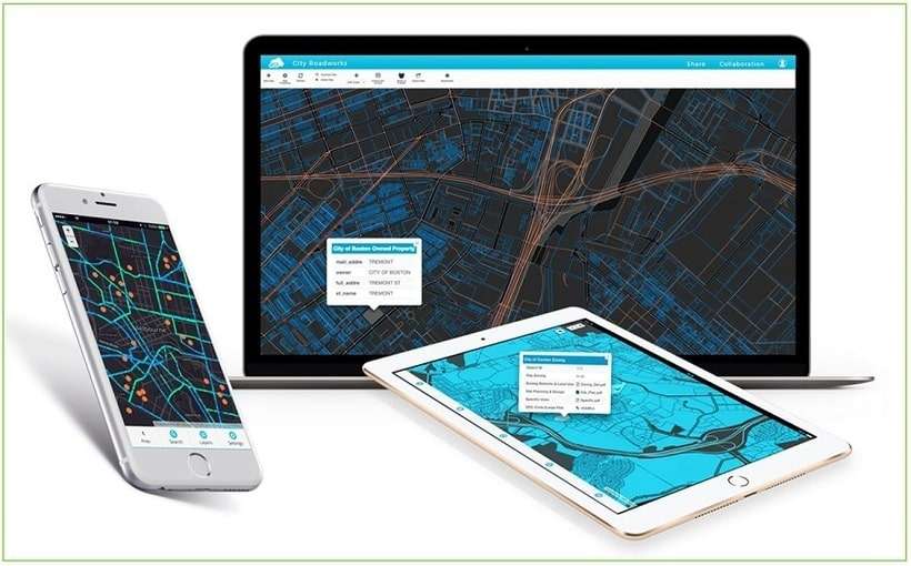
AI-based image recognition is a technology that uses AI to identify written characters, patterns, human faces, objects and […]
Continue readingAI-based image recognition is a technology that uses AI to identify written characters, patterns, human faces, objects and […]
Continue reading[1.] Python programming Python is one of the most popular, high-level, general-purpose and object-oriented programming language. It is […]
Continue readingGeographical Information Systems (GIS), remote sensing and mapping play a vital role in climate change monitoring, adaptation and […]
Continue readingTechnological revolution is here… at last! We’re living in technological disruption era! The 4th industrial revolution (4IR). Predicting […]
Continue readingHave you often wondered how to share CAD drawings online? Oh, worry no more! In the software market, […]
Continue readingWe’ve launched an open e-learning Platform (KEP) [https://e-learning.co.ke] which leverages on ILIAS core web development technologies and components […]
Continue readingMapping the world using Global Change Detection AI often involves leveraging artificial intelligence (AI) and satellite or drone […]
Continue readingOrbital Geoportal is a GIS -based platform for disseminating open geospatial datasets, metadata and maps for Kenya and […]
Continue readingThe Hexa eVTOL (electric vertical takeoff and landing) is a personal aerial vehicle designed and manufactured by the […]
Continue readingThe Insta360 Pro II is a professional-grade spherical Virtual Reality VR 360 camera that captures high-resolution 360-degree videos […]
Continue readingJust drop us an e-mail anytime. We endeavour to answer all enquiries within 2 hours on business days.